Leveraging Location Intelligence for Effective EV Infrastructure Placement and Market Trend Analysis

Understanding the pulse of the electrical vehicle (EV) industry depends on more than just general market trends. It's about diving deeper into the critical role of location intelligence. Are you aware that the vast ocean of geographic, demographic, and economic data could be harnessed to strategically plan EV infrastructure? The key lies in being able to decode the precise insights that location intelligence offers.
Location intelligence stands as the linchpin that binds territory planning, infrastructure layout, and market penetration strategies together in the EV world. Without it, the prospect of shaping a future-ready, eco-friendly, and accessible EV network remains a mirage.
Let's demystify this complex web of location intelligence, explore its pivotal influence on understanding market trends, its benefits, and strategies for effective EV infrastructure positioning in this article. It's time to comprehend how these hidden nuggets of analytical data can launch the EV industry into a realm of unprecedented growth.
If you've ever used a GPS to navigate unfamiliar terrain or followed the progress of a delivery through an app, you've tapped into the power of location intelligence. But what may seem like simple daily conveniences are actually driven by complex and sophisticated technology that goes beyond simple point-to-point mapping. In the rapidly evolving Electric Vehicle (EV) sector, this technology – known as Location Intelligence – holds the key to efficient and effective placement of infrastructure.
Location Intelligence combines the process of spatial analysis with traditional data, effectively adding the critical dimensions of timing and location. Using technologies like GPS, Location Intelligence captures and maps the movement and location of objects or people, providing valuable reference points for detailed geospatial analysis. Cities, for example, use this technology for various applications, including urban planning, emergency response planning, or natural resource management.
.gif)
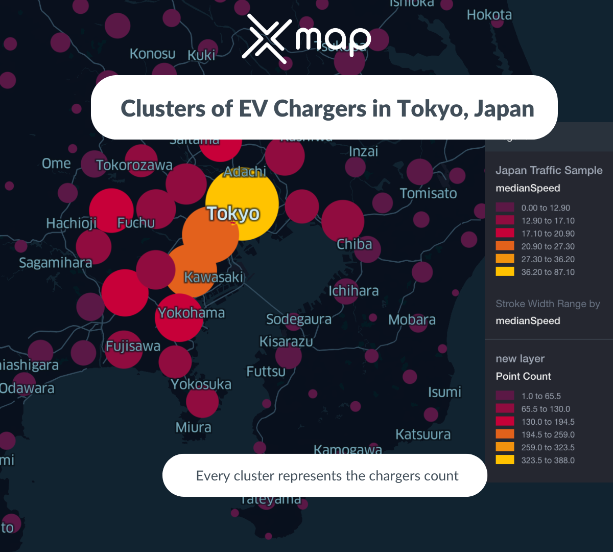
In the context of EV infrastructure, this translates into the ability to identify the optimal locations for charging stations based on several factors. These may include the flow of traffic, the density of EV usage, proximity to amenities or even the availability of sustainable energy sources. By harnessing Location Intelligence, stakeholders can inform their decision-making and strategy for EV infrastructure layout, optimizing accessibility and usability for end users.
Spatial interaction models, such as gravity models, further refine the potential of Location Intelligence. These models estimate the flow of people, material, or information between locations in geographic space. In the case of EV infrastructure, this could reveal the potential surge in demand in specific locations during certain times, useful info for effective deployment of resources.
More than just predicting demand and understanding usage patterns, Location Intelligence is also crucial for identifying potential risks. It can reveal linkages between environmental hazards and potential exposures, informing necessary precautions that need to be taken while planning the EV infrastructure. Whether it's geographically vulnerable areas or zones prone to heavy pollution, intelligent location data can provide the insights needed to prevent or manage such risks proactively.
In short, location intelligence isn't just about understanding where to place EV infrastructure, but about how to leverage optimal locations for maximum benefit and minimal risk. Just as a GPS helps you navigate your world, Location Intelligence helps stakeholders navigate the complex loggerhead that is the placement of EV infrastructure.

The first step in leveraging location intelligence is collecting and analyzing geospatial data. Such data includes information like population density, road networks, electricity grid capacity, and local policies promoting EV use. The data analysis process should adhere to best practices to maximize the benefits of geographical data.

Once data is collected, the application of spatial interaction models can help optimize EV infrastructure placement. These models take into account central locations, the scale of demand, and the spatial distribution of potential EV users.

Geospatial analysis necessitates high-performance computing, substantial data storage, and significant network bandwidth. Organizations must ensure their infrastructure can handle such demands, as they are critical to analyzing complex geographic data patterns and relationships.

It's important to pay attention to geographic relationships, such as connectivity and direction, as these can significantly impact the interplay between entities. For instance, routes with high connectivity should be prioritized for EV infrastructure to maximize user accessibility.
In conclusion, thoughtful and strategic use of location intelligence can greatly enhance the positioning of EV infrastructure, positively affecting its accessibility to the public and overall impact. Understanding and applying these strategies is vital to the success of any EV infrastructure project.
As you dive deeper into the dawn of the EV industry, it's critical to grasp that location intelligence isn't just an innovative tool—it plays an indispensable role in decoding market trends. Picture this: using location intelligence allows businesses to enhance traditional data with timing and geographical location information, thereby building precise data visualizations.
At its core, geospatial analysis integrates and interprets geographical data, uncovering patterns, trends, and insights that guide decisions. The widespread acceptance and use of Global Positioning Systems (GPS) have made this process even more precise and enriching. GPS technology secures and retains data on location and movements, providing an invaluable reference point for geospatial analysis. The goal? To identify patterns, trends, and relationships that offer clues into business movement, strategy, and growth.
Location is no longer a static descriptor — it's a dynamic component of data, thanks to the advent of geospatial technology. Whether it's Geographic Information Systems (GIS), remote sensing, or GPS, these technologies allow us to capture, analyze, and visualize pertinent information about the Earth's physical features and characteristics. The results? Businesses can understand and manage complex patterns and relationships, making more intelligent and strategic decisions, particularly in the electrifying world of EV infrastructure placement.
In the ever-evolving Electric Vehicle (EV) industry, harnessing location intelligence fosters significant benefits. Businesses that exploit geospatial analysis obtain valuable insights that inform strategic decision-making, shaping the future of this high-potential sector.
Geospatial analysis and location intelligence provide a comprehensive perspective of various elements in a geographical context. This enables businesses to make informed choices about everything from strategic site locations for charging stations to potential partnerships with localities and businesses. These decisions ultimately impact the growth, profitability, and longevity of your enterprise in the EV industry.
Operating within an industry that hugely relies on technology necessitates efficient usage of resources. With location intelligence, businesses can monitor and manage the deployment of resources efficiently. In a practical sense, this involves optimizing energy use, minimizing wastage, and improving overall operational efficiency. You’ll appreciate this, as it directly contributes to the bottom line.
By understanding how environmental hazards and potential exposures are linked through geospatial analysis, businesses can contribute to the safety of the public. This becomes particularly relevant when planning charging station locations - by minimizing exposure to environmental hazards, businesses can safeguard the community, building their reputation as responsible and eco-conscious entities.
Having a clear view of the what, where, and how of your business operations improves how you communicate with stakeholders ranging from partners and customers. Being better informed leads to a clear, transparent communication chain, fostering trust and loyalty in your brand.
To fully leverage the power of location intelligence, businesses in the EV sector must focus on efficient geospatial data analysis. Adhering to best practices is key in unraveling complex patterns and relationships that, when understood, can give your enterprise a competitive edge.
Looking at the future of the EV market, location intelligence is poised to be a pivotal element in mapping its growth and expansion. As this data-driven methodology embraces the modern facilities of geospatial analysis and GPS technologies, EV companies are better equipped to understand the dynamics of their potential market locations and make informed decisions
With the aid of spatial interaction models such as gravity models, they can visualize the flow of people, materials, or information in a geographic area, thus optimizing infrastructure placement. These models consider various geographic relationships such as connectivity and direction, which could, in turn, influence relationships among entities. This detailed categorization of variables affords companies the ability to make precise predictions about demand and usage, hence their strategic planning hits closer to the mark.
Geospatial analytics takes the data game a notch higher. It does not only record location and timing details, but also creates impactful data visualizations. These visual graphs, charts, and maps make complex data easier to comprehend and provide a visually engaging representation of market trends. This simplification process aids in avoiding costly mistakes and realizing opportunities in otherwise obscure market patterns.
Firstly, xMap Data enables efficient geospatial data analysis, a crucial step in understanding and managing complex spatial patterns and relationships. It adheres to the best practices of geospatial analysis, ensuring that your business can leverage the full power of geographic data.
Further, xMap Data helps to build robust data visualizations, adding a spatial and temporal component to your regular data. Such visualization offers unique insights that can help you make informed decisions, plan better, manage resources efficiently, and even enhance public safety.
Moreover, the power of xMap Data extends beyond these practical applications. It also helps businesses navigate the challenges of map-based spatial analysis. Maps, while an excellent medium for presenting data, can sometimes complicate spatial analysis due to their scale and representation. xMap Data helps overcome these challenges by ensuring accuracy and precision in map-based spatial analysis.
Lastly, xMap Data is not limited to the EV industry alone. Its applications span across multiple fields, including urban planning, disaster response, environmental management, public health, and marketing – making it a versatile tool for any organization.
By adopting xMap Data as part of your location intelligence strategy, your business can unlock a suite of benefits, from better decision-making to improved efficiency. It's not just about understanding where to position EV infrastructure effectively, but also about how you can be ahead of market trends and be prepared for what lies ahead.

Whatever your goal or project size, we will handle it.
We will ensure you 100% satisfication.
"We focus on delivering quality data tailored to businesses needs in the middle east. Whether you are a restaurant, a hotel, or even a gym, you can empower your operations' decisions with geo-data.”


