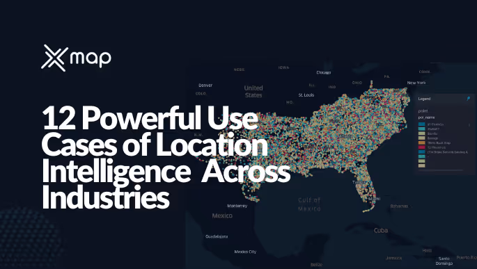
12 Powerful Use Cases of Location Intelligence in 2025 Across Industries
- Remove the current class from the content27_link item as Webflows native current state will automatically be applied.
- To add interactions which automatically expand and collapse sections in the table of contents, select the content27_h-trigger element, add an element trigger, and select Mouse click (tap).
- For the 1st click, select the custom animation Content 27 table of contents [Expand], and for the 2nd click, select the custom animation Content 27 table of contents [Collapse].
- In the Trigger Settings, deselect all checkboxes other than Desktop and above. This disables the interaction on tablet and below to prevent bugs when scrolling.
Companies in 2025 are leveraging maps and spatial data in surprising ways, turning location insights into tangible business value.
Ever wonder how businesses always seem to be in the right place at the right time? From picking the perfect store location to deploying disaster relief, organizations are using location intelligence to work smarter. In simple terms, location intelligence means analyzing geographic or spatial data (think maps, GPS, demographics) to gain insights for decision-making.
It’s become a go-to strategy across industries for one reason: it works. According to a recent Boston Consulting Group survey, 95% of executives say mapping and geospatial analytics are crucial for achieving business results, and 91% expect these tools to grow even more critical in the next few years.
No wonder the location intelligence market is booming – it’s projected to reach $34.99 billion by 2029 with a healthy annual growth rate of ~14%.
What’s driving this excitement? In a word, results. Companies rely on spatial data for everything from efficiency and cost control to finding new growth opportunities. And we’re not just talking maps with pins – we’re talking advanced geospatial analytics solving real business problems.
Think spatial data for business decisions like where to open your next retail store, how to optimize delivery routes, or even pinpointing where to install electric vehicle chargers. In fact, today’s location intelligence applications span virtually every sector. It can range from planning an EV charging network rollout to designing 5G coverage maps – every single industry is finding ways to use location data to get ahead.
Ready for a tour? Let’s explore 12 powerful location intelligence use cases – real-world examples of how industries are using spatial data to boost efficiency, drive growth, and gain an edge.
These geospatial analytics applications show how maps meet data to solve problems in retail, logistics, real estate, healthcare, energy, and more. By the end, you’ll see how industries use location data in 2025 as practical business solutions delivering competitive advantage.
1. Retail: Pinpointing the Perfect Store Location
Ever wonder how Starbucks or your favorite brand decides where to open a new store? They’re not throwing darts at a map. Retailers today use location intelligence to analyze foot traffic patterns, local demographics, nearby competitors, and even mobile check-in data before choosing a site.
For example, Starbucks famously studies neighborhood income levels and transit flows around potential corners, which has cut their store location risks by 20%. Instead of gut feel, they rely on hard spatial data – who walks or drives by, how often, at what times – to predict if a spot will thrive.
It’s paying off. By blending social media location tags with maps of customer behavior, seven in ten retailers have improved customer acquisition for new stores. That means 70% of retailers see more customers when they use location data to guide where they set up shop. They’re using tools to visualize “hotspots” of demand on a map, like an X-ray of consumer opportunity.
Is there a high concentration of your target millennials in that zip code? How far is it from the nearest competitor? Retail location platforms crunch all this. The result: store site selection is no longer a guessing game, it’s a strategic, data-backed decision. The emotional nuance here? Relief and confidence – business owners can open a new location without losing sleep that they picked the wrong side of town.
And you know what? When you walk into a perfectly situated boutique or cafe, chances are a whole lot of spatial analysis went into getting you through that door.
(Transition: You’ve got the store – now you need shoppers. How do businesses drive foot traffic to the right location? That’s where marketing goes local.)
2. Marketing Goes Local: Geotargeting Customers Where They Are
So you’ve opened the perfect store – now how do you get people to show up? Enter geomarketing, the art of using location data to tailor ads and outreach. If you’ve ever received a coupon on your phone for a shop right when you were nearby, that’s location intelligence in action. Marketers analyze where their customers live, work, and hang out, then craft campaigns that hit home (sometimes literally, by postal code). In fact, 63% of financial service leaders say geolocation-based marketing is now a key part of their strategy. It’s not limited to banks – retailers, restaurants, and brands across the board are tapping into location data to boost engagement.
How does it work? Brands study geotagged social media posts and “check-in” data, then target customers by neighborhood or even by specific block. The results have been impressive – this hyper-local approach has lifted campaign engagement by half on average. Imagine a 50% bump in people clicking your ad or visiting your promotion because it spoke to their local context.
One example: fast food chains noticed via location data that certain outlets were popular weekend hangouts. So they focused mobile ads and special deals in those exact areas. The outcome? Weekend sales at those locations jumped noticeably. It feels a bit like magic – but it’s really spatial analytics uncovering patterns of where and when customers are most receptive.
This use case shows the power of location data business solutions for marketing: instead of one-size-fits-all ads, companies deliver the right message at the right place and time. It’s more relevant for you (hey, a sale at the mall you’re walking through!) and more efficient for the business. And it’s not just retail: real estate agencies target ads to people who live in specific neighborhoods, and auto dealers geofence their lots to ping nearby prospects.
It’s marketing that meets you where you are. Honestly, doesn’t it feel nice when an offer actually matches your location and mood? That’s no coincidence – that’s location intelligence.
(Transition: Speaking of getting things where they need to be – let’s talk deliveries. Not all shopping is in-store, and location intelligence has a huge role in speeding up e-commerce logistics.)
3. E-Commerce & Delivery: Faster Routes for Online Orders
In the age of instant gratification, we’ve all tracked a package on a map. E-commerce companies are obsessed with the “last mile” – the final leg from a warehouse to your doorstep. It turns out, location intelligence is the secret sauce behind those ever-faster delivery times. How so? Companies use real-time traffic maps, GPS tracking, and route optimization algorithms to guide their delivery vans and couriers.
They’re crunching spatial data on the fly: traffic jams, weather disruptions, the optimal sequence of drop-offs – all to shave minutes off each delivery. After one major retailer switched to dynamic route planning (think software that re-routes drivers on the fly), their urban delivery reliability hit 92% on-time and average delivery times fell by over a third. Yes, you read that right – they knocked off one-third of the time it used to take, just by getting smarter with maps and data.
If you’re wondering, “Is a few minutes here or there such a big deal?” – absolutely. At scale, faster routes mean more packages delivered per driver and happier customers who aren’t waiting around. And there’s more: location intelligence also helps with reverse logistics, the fancy term for handling returns.
By mapping return drop-off points and transportation routes, retailers identified patterns (like certain neighborhoods with high return rates) and streamlined those processes, cutting related costs by 28%metapress.com. It’s all about efficiency.
Here’s the thing – we as consumers now almost expect that the product we ordered this morning will be on our porch by evening. That’s only possible because behind the scenes, geospatial analytics are optimizing every turn and stop. Dispatch systems assign deliveries based on your location relative to a driver’s current route. If there’s a traffic accident on Main Street, the algorithm knows and instantly reroutes the van to take 2nd Avenue instead.
It’s like having a logistics wizard overseeing each package. For e-commerce companies, this translates to fuel savings, on-time guarantees, and the ability to scale up without chaos. For us, it means not having to wonder if our package got lost. Pretty cool, right?
(Transition: Delivering to customers is one piece of the puzzle. Now let’s zoom out to the bigger picture of moving goods – the world of global logistics and supply chains.)
4. Logistics & Supply Chain: Routing Smarter, Running Leaner
Think of the vast network that gets products from factories to warehouses to stores – it’s a complex dance of trucks, ships, and planes. Logistics managers have a new best friend in location intelligence. By analyzing shipping routes, transportation networks, and even traffic and weather data, companies are cutting costs and delays in a big way.
For example, global shipping firms now use live maps of weather systems and road traffic to chart the most efficient paths for their fleets. The payoff? Some trucking companies trimmed fuel consumption by over 20% and reduced idle truck time by 15% just by avoiding congestion and optimizing routes. Those savings add up not only in dollars but also in lower carbon emissions – a win-win for business and the planet.
Even the giants are on board. Maersk – one of the world’s largest shipping lines – reportedly saved over a million metric tons of CO₂ emissions last year by using precise route selection based on location data analytics.
That’s the equivalent of tens of thousands of cars taken off the road. And it’s not just long-haul routes; high-resolution mapping has enabled autonomous trucks to handle nearly half of cross-country freight trips in the US. Yes, nearly 50% of long-distance trucking in some places is now aided by autonomous or semi-autonomous tech, which only functions thanks to extremely detailed spatial data (imagine the map detail needed for a self-driving truck to make a 2,000-mile journey safely!).
Location intelligence also helps with where to place distribution centers and warehouses. Firms simulate various location scenarios: If we open a warehouse in City X, will it cut delivery times to our stores by 20%? Maybe the data shows that a location near a major highway reduces distance to key markets – decision made. German carmakers recently recalculated their warehouse locations using these tools and slashed transfer costs by almost one-third, while also trimming inventory waste by nearly 25%.
The emotional result for logistics managers is a sigh of relief – fewer headaches from delays, clearer insight into where things are at any moment, and pride in a supply chain that runs like a well-oiled (or rather, well-mapped) machine. It’s all about getting the right product to the right place at the right time – and maps have become indispensable in making that happen.
(Transition: All this talk about locations for stores and goods – what about locations for buildings and investments themselves? Next, we look at how real estate is leveraging spatial smarts.)
5. Real Estate & Land Use: Data-Driven Property Decisions
In real estate, they say “location is everything” – and now they have the data to prove it. Whether it’s a retailer scouting for their next storefront or a developer planning a new apartment complex, location intelligence has become the realtor’s secret weapon. Instead of relying solely on intuition or a drive-by impression, property professionals can now pull up layered maps showing exactly what they need: population trends, income levels, school proximity, crime rates, traffic counts, you name it.
The result? Finding the right property at the right time (and price) has gotten a lot more scientific. One real estate platform boasts that it can overlay data on local amenities, transit, and demographics to give instant insights into a site’s potential value. Imagine being able to rate a location’s appeal with a single “location score” – that’s where we’re headed.
For instance, location intelligence tools let developers identify up-and-coming “hotspot” neighborhoods by analyzing patterns like new business openings, increases in foot traffic, or shifts in age demographics. Developers can spot the next trendy district before everyone else does, giving them a huge competitive edge.
They’re also using spatial data to avoid pitfalls: flood zone maps, environmental risk layers, and infrastructure plans help avoid buying land that might be underwater (literally or financially) in 10 years. In India, the introduction of digital land records (like the Bhu-Aadhaar initiative) and GIS-based property databases has made it easier to verify land ownership and reduce disputes – a big leap in efficiency and trust for the real estate market.
The benefits are clear. Location intelligence provides deeper insight into property values, foot traffic, and even consumer behavior around a site. Commercial real estate firms use it to choose store locations for clients by analyzing competitor locations and pedestrian flow – essentially ensuring strategic site selection that maximizes ROI.
Cities and urban planners, on the other hand, use the same data to plan smarter zoning and infrastructure. For example, a city government might use location data to identify areas with poor access to parks or grocery stores and then provide incentives for development there. As one blog nicely put it, it’s no longer about finding a property, but finding the right property in the right place at the right time.
Real estate decisions have turned into data-driven choices, and it’s transforming the industry from a high-stakes guessing game into a transparent, map-informed science. The homebuyer or business tenant may not see all that under the hood, but they do end up with a location that truly fits their needs – and that’s priceless.
(Transition: Buying property involves big money and big risk – which is a perfect segue into our next use case. How do insurers and financiers use location data to manage risk and fraud?)
6. Insurance & Finance: Mapping Risk and Preventing Fraud
When it comes to insurance, where something happens is as important as what happens. That’s why insurance companies were early adopters of location intelligence – they live and die by risk assessment. These days, insurers use detailed risk maps and geospatial data to set premiums and catch fraudsters. For example, by overlaying historical flood zone maps on their policy database, carriers noticed a stark pattern: properties in coastal flood zones carry premiums about 40% higher than similar properties outside those zones.
It makes sense – if your house is in a flood-prone area, the risk (and thus insurance cost) is higher. Location data makes these calculations precise down to individual addresses. They’re not just relying on broad ZIP code tables anymore; it’s satellite imagery and flood modeling at work in the underwriting process.
Location analytics is also a superhero in fighting insurance fraud. Picture this: an auto insurance claim comes in for a “stolen” car. The claimant says it was taken from a certain street. In the past, the insurer might have to do some detective work. Now, they can check the car’s last known GPS or even the owner’s smartphone location (with permission) and see if the story checks out.
By matching claims to geotagged data, insurers have reduced fraudulent claims by nearly 20%. One insurer noted that simply verifying if a supposed accident location has a history of staged crashes or if the claimant’s phone was nowhere near the claimed location at the time can flag potential fraud instantly. It’s like having a digital lie detector based on maps.
And when disaster strikes – a hurricane, wildfire, or major storm – location intelligence becomes a lifeline for finance and insurance. Companies deploy drones and satellite imaging to assess damage in real time, often before it’s even safe for adjusters to enter an area. This speeds up insurance payouts dramatically.
During a recent string of storms, one major insurer used real-time satellite data and on-the-ground location markers to triage claims, and it cut payout cycles in half for the victims. In practical terms, that means people got their money weeks sooner than they used to, helping them rebuild their lives faster.
Banks and investment firms are in on the act too. They use location data to guide decisions like where to open new branches (which overlaps with our retail use case) and to assess loan risk (for example, understanding if a factory is in a wildfire zone might affect a loan’s terms). Microfinance programs have mapped remote villages to better target lending and track repayment patterns – one report noted rural loan defaults dropped 17% after incorporating precise mapping of borrowers.
The common thread? Location intelligence turns the abstract concept of “risk” into something visible and measurable on a map, whether it’s crime rates for underwriting or proximity to fire stations for setting home insurance prices. The numbers get more accurate, the decisions get smarter, and we customers ultimately benefit from fairer pricing and faster service (with hopefully a few less fraudulent claims driving up everyone’s premiums!).
(Transition: Not all uses of location data are about dollars and cents. Some are about life and death. Next up, let’s see how healthcare is using location intelligence to save lives and improve public health.)
7. Healthcare: Mapping Health for Better Care
It turns out maps can save lives. Healthcare providers and public health officials are using location intelligence to make sure the right care is in the right place – and to stop disease outbreaks in their tracks. A classic example is planning hospital or clinic locations. By mapping patient addresses and demographics, health systems can spot gaps in coverage.
One hospital network found that certain rural areas had lots of patients driving hours for an MRI. So they reallocated resources, and this effort sped up rural MRI access by 25% – meaning patients in those areas got scans done much faster without the long wait or drive. That’s a tangible improvement in quality of care just from analyzing spatial data on where patients live relative to medical facilities.
Public health agencies also live by the map. If there’s an outbreak of, say, dengue fever or COVID-19, mapping the cases is step one. In 2024, health agencies used live heatmaps of dengue fever cases to direct their response, targeting high-risk neighborhoods for mosquito control and awareness campaigns. The result: infection rates in those targeted zones dropped by more than a third.
That’s huge – think about a contagious disease being curbed 33% simply by acting on geospatial insights of where it’s spreading. We all became a bit familiar with this concept during the pandemic, with those ubiquitous COVID hotspot maps guiding lockdowns and vaccine drives. It’s the same idea: visualize it, understand it, act on it.
But it’s not only outbreak crises. Healthcare uses location intelligence for everyday well-being too. Telemedicine has boomed, but not everyone has broadband or lives near a big hospital. By analyzing maps of broadband access and population age, innovators placed thousands of telemedicine kiosks in communities lacking doctors but having decent internet connectivity.
In the U.S., this meant bringing basic healthcare services to millions of seniors who otherwise had to travel far for care. Just think – a senior in a rural town can step into a local pharmacy kiosk and virtually meet with a doctor, all because someone mapped out which towns needed that service the most.
Emergency services are another facet: ambulance fleets use location data to position themselves during peak hours. If data shows more heart attacks on the east side of a city in the mornings (perhaps due to an older population there), EMS might station an ambulance closer by during those hours. This kind of dynamic deployment, guided by geospatial analysis, has led to 19% faster emergency response times in some areas. In an emergency, 19% faster can literally mean the difference between life and death.
So whether it’s allocating ventilators during a crisis or deciding where to open the next urgent care clinic, healthcare is embracing location intelligence. For patients, it means more equitable access (since resources are placed where they’re needed most) and often better outcomes. It’s a great example of technology adding a human touch – using data to ensure no community is left off the health map.
(Transition: Health is deeply personal, but location data is also shaping the big picture of our cities and communities. Let’s move from hospitals to city halls – how urban planners use location intelligence for smarter cities.)
8. Urban Planning & Smart Cities: Building Better Communities
Ever use a smartphone app to find the nearest open parking spot? Or notice how some cities have synchronized traffic lights that actually respond to traffic conditions? That’s location intelligence fueling smarter urban planning. City planners and public officials are now swimming in data from sensors, GPS devices, and satellites – and they’re putting it to work to make city life more efficient and livable.
Take traffic management: in Barcelona, the city integrated sensor data on traffic flow into dynamic models and managed to cut congestion by nearly 20%. Imagine 20% fewer traffic jams – that’s less road rage, less pollution, and people getting home faster. They also used location data to optimize parking, with apps guiding drivers to available spots. The result? Residents in some areas find parking three times faster than before. If you’ve ever circled the block for half an hour looking for parking, you know how huge a 3× improvement is!
Urban planning is essentially the art of deciding where to put things in a city – roads, schools, parks, you name it. Traditionally, that involved a lot of surveys and best guesses. Now it’s incredibly data-driven. Planners use GIS (Geographic Information System) tools to layer maps of population density, public transit lines, income levels, and even tree cover to find the best solutions.
For example, a city could map areas that are “park deserts” (neighborhoods beyond walking distance from a park) and then prioritize those areas for new green spaces. Or use heat maps to identify intersections with high accident rates and redesign them. One city did flood risk simulations by combining terrain data and rainfall patterns, pinpointing exactly which levees and drains to upgrade. In Jakarta, such simulation-driven planning helped shield over two million people from seasonal flooding by reinforcing the right infrastructure. Seeing a potential flood on a map before it happens and fixing the weak spots – talk about proactive planning!
This is the spatial data for business of running a city. Public services can be deployed more effectively: garbage collection routes are optimized (saving fuel and keeping streets cleaner), emergency responders are pre-positioned in the areas they’re most needed, and even urban development decisions (like where to encourage new housing or retail) are based on real data about community needs.
It also brings citizens into the loop. Many cities now offer open data portals with interactive maps – you can see plans for bike lanes, construction, or crime stats in your neighborhood. It makes planning more transparent and inclusive. Ultimately, location intelligence in urban planning leads to cities that feel better organized – because they are. Shorter commutes, safer streets, and smarter growth don’t happen by accident; they happen by design, with a big assist from those detailed maps and models.
(Transition: We’ve seen cities plan for the good times, but what about the bad times? Location intelligence is equally powerful when disaster strikes, which is our next use case.)
9. Disaster Response & Public Safety: When Maps Save Lives
When hurricanes, wildfires, or floods hit, every minute counts. One of the unsung heroes in these moments is location intelligence. By mapping danger zones and resources in real time, emergency managers can make life-saving decisions faster. A dramatic example came during the 2025 California wildfire crisis: emergency teams monitored geotagged social media posts (people marking themselves safe or calling for help with location tags) and used that data to orchestrate evacuations.
They were able to reroute over 34,000 people to safety in under half a day by analyzing where road closures were and which evacuation centers had capacity. Just think about that – tens of thousands of lives potentially saved or at least helped, thanks to quick thinking with maps and tweets. It gives “real-time mapping” a whole new level of importance.
Disaster response is all about knowing what’s happening where, as it happens. Modern systems integrate satellite imagery, drones, and sensors to create live crisis maps. If an earthquake strikes, within minutes responders can have a map highlighting the hardest-hit areas (say, by analyzing Twitter or 911 call volumes by location) and the nearest available hospitals or shelters.
This means they send help first to the places that need it most. It’s triage via GIS. We saw this with flood responses too – during monsoon floods in Asia, governments used simulations and on-the-ground water level sensors to predict which neighborhoods would flood next. They evacuated those areas proactively. In one case, flood terrain mapping in Jakarta identified exactly which levees to reinforce, protecting over 2 million residents from flooding. That’s prevention, not just reaction.
Another aspect is disaster logistics. When a lot of relief supplies (food, water, medicine) are coming into a region, where do you set up distribution? Location analytics helps find safe, accessible staging areas and optimizes routes for relief trucks (similar to our delivery use case, but with higher stakes). Organizations like the Red Cross use heatmaps of power outages, population density, and road conditions to decide where to open aid centers.
Even drones with thermal imaging maps have been used to find people stranded after events like hurricanes, by detecting body heat from the air in areas human searchers might not reach quickly. And let’s not forget public communication: many regions now have emergency alert systems that send geo-targeted texts – if you’re in the polygon of a tornado warning, you get the alert.
That’s location intelligence saving your life with a ping on your phone. The emotional impact of all this is huge. It means chaos is a little more under control. For families in a disaster, it means help reaches them sooner. For first responders, it’s like having a live guide in the dark, showing where to go and what to prioritize. In the worst of times, maps truly shine.
(Transition: Now, shifting from emergencies to energy – the next use case explores how the push for electric vehicles and renewable energy relies on location smarts.)
10. Energy & Utilities: Powering Up with Spatial Insights
As electric vehicles (EVs) become common, utilities use location data to decide where new charging stations should go for maximum impact.
The energy sector is undergoing a transformation – think renewables, smart grids, and electric cars – and location intelligence is at the heart of it. Let’s talk about EVs first. As electric vehicles surge in popularity, a big question arises: where do we need charging stations? Utilities and EV charging companies are using location data to map out the best sites for new charging infrastructure. They analyze driving patterns (thanks to connected car GPS data), population density of EV owners, and even points of interest like shopping centers where drivers might top up while they shop.
By doing so, they can predict where an EV charger will get used versus where it might sit empty. For example, if data shows a busy highway corridor has a growing number of EVs traveling it daily, that’s a prime spot for a high-speed charger. Companies providing EV charging services track how many EVs frequent certain routes or areas, and use that to identify exactly where to place new charging stations. The goal is to ensure no EV driver is left stranded without power. And from a business standpoint, it avoids investing in chargers that won’t be used.
This is critical for initiatives like national EV corridor programs. In the US, the NEVI (National Electric Vehicle Infrastructure) program is pumping billions into EV charging along highways. States are leveraging location intelligence to decide, for instance, that a charging hub every 50 miles on Interstate highways is needed – but exactly where those go is determined by looking at exit amenities, traffic data, and grid capacity. In short, spatial planning is preventing “charging deserts” and guiding a smoother EV rollout.
One industry example: power utilities have started using location analytics to anticipate future electricity demand at the neighborhood level. If an area has a high uptake of EVs (which you can gauge from EV registration data and even the presence of chargers), the local grid might need an upgrade to handle all those cars plugging in at night. Better to reinforce that transformer now than wait for blackouts later.
Beyond EVs, location intelligence is also optimizing where to build renewable energy projects like wind farms or solar arrays. Companies use GIS to find the sunniest spots for solar (while also checking land availability and proximity to transmission lines). For wind, they map wind speeds, land elevation, and environmental factors to pinpoint ideal turbine locations.
It’s a far cry from the old days of trial-and-error site selection. And once these sites are running, they monitor performance spatially – if one wind turbine is underperforming, maybe the data shows it’s due to turbulence from a hill nearby. Move it a bit, problem solved. Even traditional utilities use location data to manage outages: smart meters report which houses have power and which don’t, so after a storm, crews see a map of outage clusters and can deploy to restore power faster.
The energy transition is a massive logistical challenge, and without location intelligence it’d be like trying to redesign a city blindfolded. With it, planners can visualize the new electric ecosystem – where cars will charge, where power will be generated, how it will flow. That means cleaner energy reaching more people with fewer hiccups. The next time you pull up to a well-placed EV charger that saved your road trip, tip your hat to the spatial analysts who likely crunched the numbers to put it there.
(Transition: We’ve covered electricity; now let’s talk connectivity. Even the placement of cell towers and rollout of 5G relies on location intelligence, as we’ll see next.)
11. Telecommunications: Optimizing Networks and Coverage
Have you ever noticed you have full bars of cell signal in places that used to be dead zones? Thank location intelligence for that. Telecom companies are masters of geospatial analysis, because their service literally depends on location coverage. When planning new cell towers or 5G antennas, they use detailed maps of population density, topography, and even building heights to determine the perfect spots.
The aim is to cover as many customers as possible with the strongest signal, while minimizing gaps. In 2025, this approach paid off big in some cities: after carriers used population and terrain models to guide tower placement, urban network reliability hit 98% – virtually blanket coverage. In rural or tricky terrains (mountains, for instance), advanced propagation modeling – essentially simulating how signals travel over hills and obstacles – shrunk coverage gaps by 44%. That’s nearly half of the former dead zones now getting a signal. For anyone who’s driven through the countryside cursing a dropped call, this is welcome news.
The rise of 5G has taken this to another level. Because 5G signals don’t travel as far as 4G, you need more micro-towers and antennas, often on streetlights or buildings. Deciding those locations is a huge puzzle: you want to offload congested areas, ensure handoffs between 5G cells are smooth, and cover popular spots like transit hubs or stadiums. Telecom engineers use location intelligence tools to map current usage and predict future demand – like, say, an upcoming concert or a new shopping mall that will draw crowds (and bandwidth). Then they plan small cell deployments accordingly. It’s a game of strategic placement, almost like chess on a city map.
Location data also helps telecoms with maintenance and customer service. Technician teams are dispatched more efficiently by analyzing routes and outage reports geographically. One provider started routing their field technicians based on live traffic and incident data; it led to a 27% increase in first-call fix rates (meaning the tech solved the customer issue on the first visit).
They get to the site faster and can schedule more smartly. Additionally, by equipping network equipment with IoT sensors and linking that to location, companies do predictive maintenance – if a cluster of cell sites in one area shows anomalies, they address it before it becomes a big outage. This proactive approach cut unplanned downtime by about one-third in the past year for some telecom operators.
In short, telecom networks are built and run on spatial logic. Every call you make or video you stream is traveling through infrastructure that was planned using maps and models of the real world. And when something goes awry, those same maps guide the fix. For customers, it means more “No Service” areas turning into “4 bars of 5G” and shorter waits if your internet goes out. For the telecom companies, it means happier customers and lower costs from fewer truck rolls and optimized capital spending. It’s easy to take for granted, but behind that little signal icon on your phone, there’s a massive geospatial choreography at work.
(Transition: We’ve talked tech and cities – let’s end our journey out in the fields. Yes, even farmers are using location intelligence to revolutionize agriculture.)
12. Agriculture: Precision Farming Down to the Last Acre
Farming may be as old as civilization, but today’s farmers are wielding high-tech maps and sensors alongside their tractors. The concept of precision agriculture is all about using location-specific data to make farming more efficient and sustainable. Think of a farmer dividing a large field into many tiny zones and managing each one optimally. In practice, tractors equipped with GPS and sensors can apply fertilizer or water only where needed, in just the right amounts, guided by soil and crop maps. Drones fly overhead, capturing images that reveal which patches of crops are healthy and which are stressed.
All this data gets layered onto field maps, enabling the farmer to “see” variability in their land like never before. The payoff is impressive: studies suggest that if even 15-25% of farms globally adopt precision agriculture, we could boost worldwide food production by 10-15% while cutting greenhouse emissions and water use by 10-20%. That means more food on the table and less environmental impact – a critical balance as we aim to feed a growing population sustainably.
Let’s break a scenario down. Suppose a farmer has a 100-acre corn field. Traditional approach: water and fertilize uniformly. The smart approach: soil moisture sensors show the east side of the field has heavier, water-retaining soil, so it needs less irrigation; the west side is sandier and needs a bit more. Satellite imagery indicates a section in the middle has some pest or disease (it’s looking less green in NDVI imagery).
The farmer uses a map app in their tractor to target just that section with an extra treatment, instead of blanketing the whole field with pesticide. They also schedule harvest in stages because their yield model (which factors in micro-climates and soil data) shows part of the field will mature earlier. This level of micro-management was impossible before, but with GPS-guided equipment and GIS analytics, it’s become feasible. The result is often higher yield with lower input cost – who wouldn’t want that? One World Economic Forum stat even predicts these tech-driven methods could save significant resources and still increase output.
Beyond the farm itself, location intelligence aids the entire agricultural supply chain. Crop transport routes can be optimized to keep produce fresh (route the trucks faster to the market). Storage and processing facilities are being located using maps of where crop yields are highest, to reduce travel distance. And in terms of risk, insurers and governments map things like drought-prone areas or floodplains to provide early warnings to farmers.
There’s even an app where farmers can report local crop conditions, which then gets displayed on a map for others – a crowdsourced intelligence network, if you will. The cultural image of a farmer might be someone surveying their land by eye from a pickup truck, but today it might be a drone feed and a tablet displaying a colorful GIS map of their fields. The amazing part? The crops don’t care – they just grow better with exactly what they need. The farmers care, though, because it means a more bountiful harvest and a more secure livelihood. Precision location data is helping agriculture achieve that age-old goal: grow more with less.
Conclusion: Mapping the Future Across Industries
From retail storefronts to remote farms, these examples show that location intelligence isn’t a niche tool – it’s a game-changer across the board. What’s the common thread in all these use cases? It’s simple: knowing “where” helps answer the “what” and “how” in business. By adding the layer of “Where is this happening?” to their decision-making, organizations are finding efficiencies, improving services, and creating new opportunities that just weren’t possible before.
It’s not just about cool maps (though they are pretty cool); it’s about insight. A delivery company can see the fastest route. A city can see where to build a bridge or a park. A retailer can see where their customers actually are. And once you see those patterns and relationships on a map, you can act on them with confidence.
It’s also clear that spatial thinking drives competitive advantage. Companies that embrace location data are often a step ahead. They’re the ones picking better sites, delivering quicker, cutting waste, and delighting customers with personalized experiences.
No wonder an overwhelming majority of business leaders plan to invest even more in location analytics – recall that 91% of execs expect geo-tools to be even more vital in the next few years. We’re going to see location intelligence entwined with AI, with real-time IoT data, and with every facet of business analytics. The world is not standing still, and neither are the maps that represent it. As industries continue to innovate, location intelligence will keep evolving – smarter algorithms, richer data (hello, billions of GPS pings), and even 3D and indoor mapping. The trend is clear: those who fail to leverage the power of “where” might find themselves, well, lost in the marketplace.
Before we wrap up, let’s take a quick glance at some key stats by industry that highlight the impact of spatial data:
As you can see, spatial data for business is delivering real, measurable benefits – from huge cost savings to life-saving response times. It’s not hype; it’s happening. And this is just a snapshot. The beauty of location intelligence is that it’s endlessly applicable: whenever you ask a question that includes “where,” there’s potential insight waiting on the map.
In 2025 and beyond, embracing location intelligence could be the difference between leading your industry or lagging behind. The technology has become more accessible (many tools are user-friendly or offer ready-to-use data layers), and the cultural mindset is shifting to appreciate that every dataset has a location aspect.
So whether you’re a business leader plotting expansion, an urban planner rethinking a city block, or a logistics manager routing trucks, remember to ask: “What can location data tell me?” The answers might surprise you – and empower you. After all, in a world full of data, knowing where things happen can make all the difference. So go ahead: put your business on the map, literally, and watch the insights unfold.
Subscribe for advanced Data analysis Tips and Reports

連絡を取る
あなたの目標やプロジェクトの規模が何であれ、私たちはそれを処理します。
100% ご満足いただけるよう努めます。
「私たちは、中東のビジネスニーズに合わせた質の高いデータを提供することに重点を置いています。レストラン、ホテル、ジムのいずれであっても、地理データを使用して業務上の意思決定を強化できます。」


