Uruguay - Road Traffic Data
Navigate the dynamics of Uruguay’s roadways with our comprehensive traffic dataset, offering insights into traffic flows, congestion levels, and vehicle types throughout the country. Ideal for government officials, urban planners, and transportation analysts, this dataset is essential for developing effective traffic management strategies, enhancing public transportation systems, and planning sustainable infrastructure improvements across Uruguay.
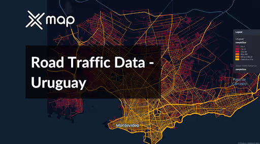


Vital Traffic Insights across the Uruguay
Analyze extensive data and studies to uncover key insights on traffic flow challenges, congested areas, and necessary speed changes, aiding in efficient transportation planning throughout Uruguay.
Download a Sample
Preview the depth and breadth of our traffic data collection, showcasing how granular insights can revolutionize transportation planning and management in Uruguay.
Key Variables
Analyze extensive data and studies to uncover key insights on traffic flow challenges, congested areas, and necessary speed changes, aiding in efficient transportation planning throughout Uruguay.
Use Cases
How can this dataset benefit you?
Utilize Uruguay’s road traffic data to enhance traffic management in Montevideo, the capital and largest city. Implement smart traffic control systems that use real-time data to optimize traffic light timings and manage vehicle flows during peak hours. This approach aims to reduce congestion, decrease travel times, and improve air quality in urban areas.
Leverage traffic data to manage seasonal variations in traffic flow to popular tourist destinations such as Punta del Este. Plan and implement temporary traffic measures during peak tourist seasons, such as rerouting traffic, enhancing public transport options, and increasing parking availability. These actions will help manage the influx of vehicles more efficiently, ensuring a smoother travel experience for both tourists and locals.
Employ road traffic and accident data to identify areas with high accident rates and implement targeted road safety campaigns and infrastructure improvements. Enhance road safety measures such as better road signage, improved lighting, and pedestrian crossings in these high-risk areas. This targeted approach will help reduce traffic accidents and enhance overall road safety across the country.
Everything You need to know to know about the Road Traffic of Uruguay
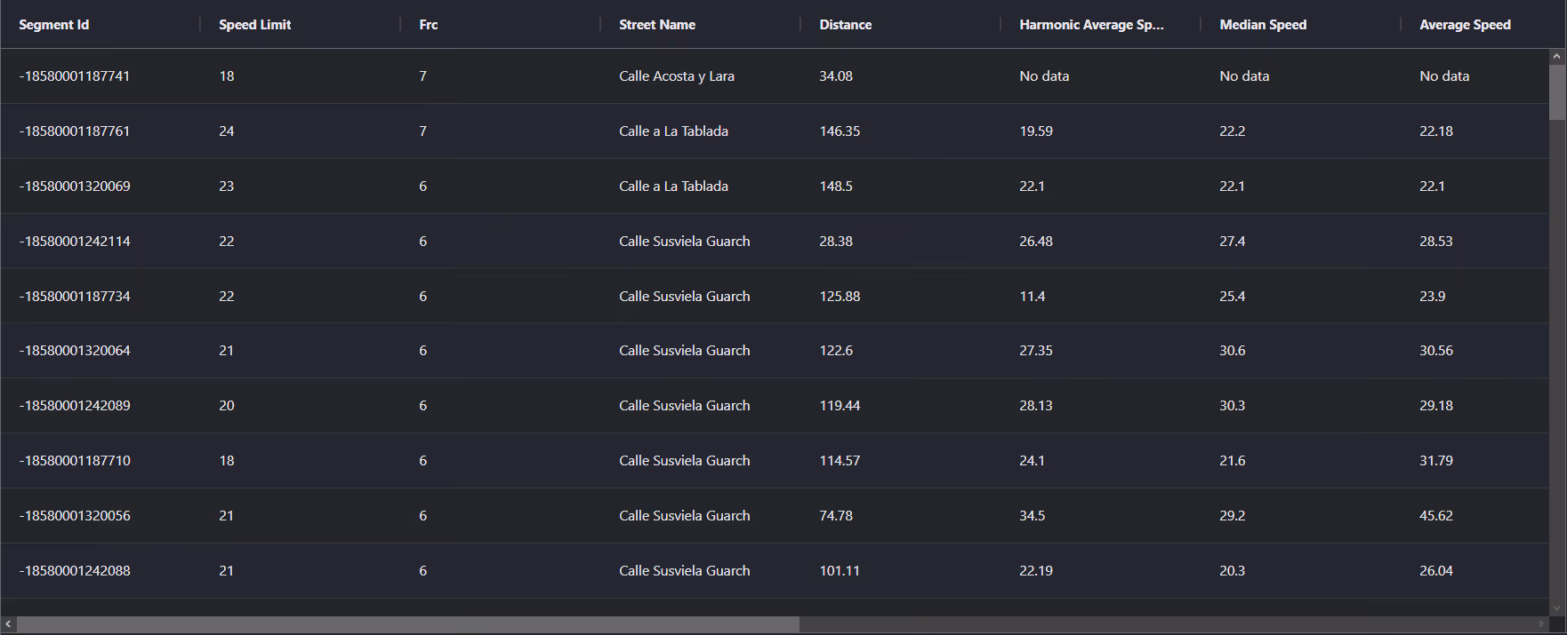
Median Vehicle Speeds by Road Names
This analysis examines median vehicle speeds across various road types, highlighting efficiency and congestion levels from highways to local streets.
Speed Limit Distribution
Investigates the range and prevalence of speed limits throughout Uruguay, identifying areas with strict regulations and potential zones for speed limit adjustments.

Functional Road Class (FRC) Distribution
Depicts the variety of road types within the network, from major thoroughfares to local streets, and their distribution across the territory.

Average Speed by Functional Road Class (FRC)
Analyzes average speeds based on road functional classifications, providing insights into traffic flow and congestion differences between arterial roads and local streets.

Average Speed Distribution for Avenida Italia
Explores speed patterns along this major road, highlighting areas of congestion or high efficiency and their impact on travel times.

Top 10 Streets by Average Speed
Lists the top 10 streets by average speed, providing an overview of traffic conditions in busy urban areas or on efficient routes.

Montevideo Street Traffic Analysis
Offers a detailed examination of traffic flow on Montevideo’s streets, including peak traffic times, average speeds, and congested areas, supported by visual data.

Why xMap?
xMap empowers businesses with unparalleled location intelligence and comprehensive data analysis, guiding them towards market leadership and growth.
Frequently Asked Questions
Find answers to commonly asked questions about our spatial analyst platform.
This dataset encompasses real-time and historical data on traffic density, accidents, road conditions, and congestion trends.
At xMap, we are committed to ensuring that our clients can leverage our datasets effectively. We provide comprehensive technical support, including help with data integration, troubleshooting, and optimization of data use. Additionally, we offer consulting services to help businesses understand and analyze traffic data to meet their specific strategic objectives.
Leverage this dataset for site selection, analyze road traffic on your desired business location, enhanced route planning, strategic urban development projects, and to implement proactive traffic management strategies.

