Taiwan - Road Traffic Data
Explore the dynamic flow of Taiwan’s roadways with our comprehensive traffic dataset, offering deep insights into traffic volumes, congestion levels, and vehicle types across this densely populated island. Ideal for transport authorities, urban planners, and environmental agencies, this dataset is crucial for implementing effective traffic management strategies, enhancing public transit efficiency, and fostering sustainable urban development across Taiwan.
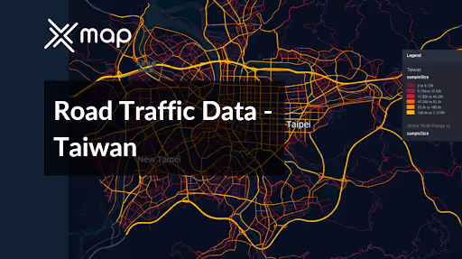


Vital Traffic Insights across the Taiwan
Examine in-depth data and research to reveal important information about traffic flow, congested zones, and required speed adjustments, assisting in effective transportation planning across Taiwan.
Download a Sample
Preview the depth and breadth of our traffic data collection, showcasing how granular insights can revolutionize transportation planning and management in Taiwan.
.avif)
Key Variables
Examine in-depth data and research to reveal important information about traffic flow, congested zones, and required speed adjustments, assisting in effective transportation planning across Taiwan.
Use Cases
How can this dataset benefit you?
Utilize Taiwan's road traffic data to enhance urban mobility in Taipei, focusing on reducing congestion and improving traffic flow through smart city technologies. Implement adaptive traffic control systems that adjust traffic lights in real-time based on current traffic conditions, and introduce dynamic routing information to drivers via mobile apps or digital road signs to optimize travel times and reduce congestion.
Leverage traffic flow data to optimize public transportation systems across Taiwan, particularly in metropolitan areas like Kaohsiung. Analyze congestion patterns and peak travel times to adjust bus and metro schedules, increase service frequencies, and extend routes to underserved areas. This strategic use of data aims to make public transport a more attractive option, thus reducing reliance on private vehicles.
Employ traffic and accident data to identify areas with high rates of traffic incidents and implement targeted road safety initiatives. Enhancements could include improving road signage, re-engineering dangerous intersections, and increasing traffic law enforcement. Additionally, initiate public awareness campaigns focusing on road safety education to reduce accidents and improve safety for all road users.
Everything You need to know to know about the Road Traffic of Taiwan
Median Vehicle Speeds by Road Names
This analysis evaluates median vehicle speeds across various road types, highlighting efficiency and congestion levels from highways to local streets.
Speed Limit Distribution
Explores the range and prevalence of speed limits throughout Taiwan, identifying areas with strict regulations and potential zones for speed limit adjustments.

Functional Road Class (FRC) Distribution
Illustrates the variety of road types within the network, from major thoroughfares to local streets, and their distribution across the territory.

Average Speed by Functional Road Class (FRC)
Analyzes average speeds based on road functional classifications, providing insights into traffic flow and congestion differences between arterial roads and local streets.

Average Speed Distribution for 市民大道高架道路
Examines speed patterns along this major road, highlighting areas of congestion or high efficiency and their impact on travel times.

Taipei Street Traffic Analysis
Presents a detailed examination of traffic flow on Taipei’s streets, including peak traffic times, average speeds, and congested areas, supported by visual data.

Why xMap?
xMap empowers businesses with unparalleled location intelligence and comprehensive data analysis, guiding them towards market leadership and growth.
Frequently Asked Questions
Find answers to commonly asked questions about our spatial analyst platform.
This dataset encompasses real-time and historical data on traffic density, accidents, road conditions, and congestion trends.
Leverage this dataset for site selection, analyze road traffic on your desired business location, enhanced route planning, strategic urban development projects, and to implement proactive traffic management strategies.
At xMap, we are committed to ensuring that our clients can leverage our datasets effectively. We provide comprehensive technical support, including help with data integration, troubleshooting, and optimization of data use. Additionally, we offer consulting services to help businesses understand and analyze traffic data to meet their specific strategic objectives.

