South Africa | Road Traffic Data
Explore the complexities of South Africa's road networks with our detailed traffic dataset, providing critical insights into traffic flows, congestion levels, and vehicle types across both urban centers and rural areas. Ideal for government bodies, urban planners, and transport companies, this dataset is crucial for devising effective traffic management strategies, optimizing public transportation routes, and planning infrastructure projects to enhance mobility and safety throughout South Africa.
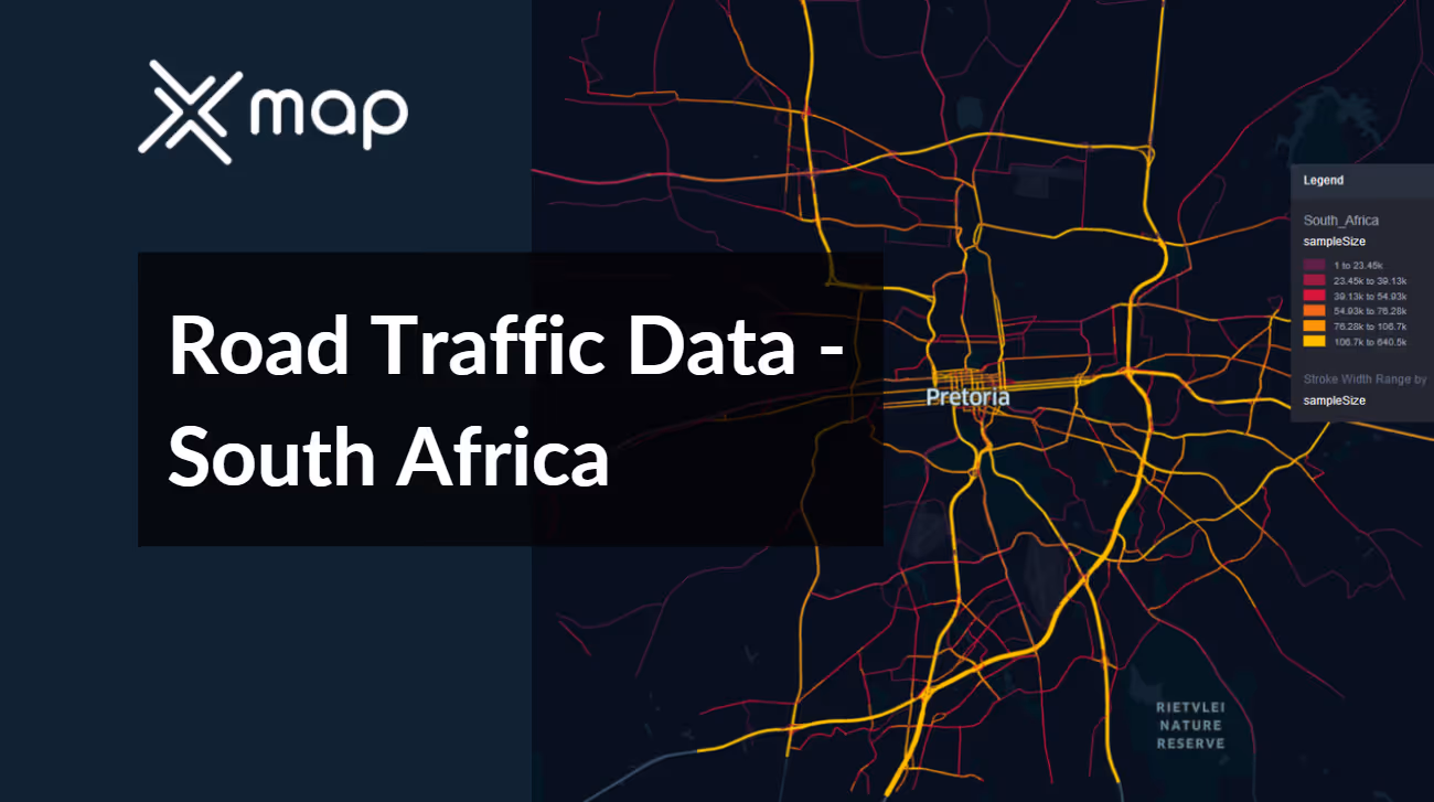


Vital Traffic Insights across the South Africa
Obtain valuable insights from in-depth data and research, providing a thorough understanding of traffic flow complexities, congested areas, and necessary speed adjustments to optimize transportation planning in South Africa.
Download a Sample
Preview the depth and breadth of our traffic data collection, showcasing how granular insights can revolutionize transportation planning and management in South Africa.
.avif)
Key Variables
Obtain valuable insights from in-depth data and research, providing a thorough understanding of traffic flow complexities, congested areas, and necessary speed adjustments to optimize transportation planning in South Africa.
Use Cases
How can this dataset benefit you?
Utilize South Africa's road traffic data to manage and optimize traffic flow in major urban areas like Johannesburg and Cape Town. Implement adaptive traffic control systems that adjust signal timings based on real-time traffic conditions, reducing congestion and improving overall traffic efficiency during peak and off-peak hours.
Leverage traffic data to enhance public transport systems, particularly focusing on the integration and efficiency of bus rapid transit (BRT) systems. Use insights from traffic volumes and congestion patterns to optimize bus routes and schedules, ensuring more reliable and timely public transport services that can attract more users away from private vehicle reliance.
Employ detailed traffic and accident data to identify and target high accident zones across South Africa. Implement targeted road safety measures such as improved road signage, enhanced pedestrian crossings, and strategic public awareness campaigns focused on driver safety and pedestrian awareness. These initiatives aim to reduce accident rates and increase safety on the roads.
Everything You need to know to know about the Road Traffic of South Africa
Median Vehicle Speeds by Road Names
This analysis examines median vehicle speeds across various road types, highlighting efficiency and congestion levels from highways to local streets.
Speed Limit Distribution
Investigates the range and prevalence of speed limits throughout South Africa, pinpointing areas with strict regulations and potential zones for speed limit adjustments.

Functional Road Class (FRC) Distribution
Depicts the variety of road types within the network, from major thoroughfares to local streets, and their distribution across the territory.

Average Speed by Functional Road Class (FRC)
Analyzes average speeds based on road functional classifications, providing insights into traffic flow and congestion differences between arterial roads and local streets.

Average Speed Distribution for Ben Schoeman Highway
Studies speed patterns along this major road, highlighting areas of congestion or high efficiency and their impact on travel times.

Top 10 Streets by Average Speed
Identifies the top 10 streets by average speed, offering an overview of traffic conditions in busy urban areas or on efficient routes.

Pretoria Street Traffic Analysis
Provides a detailed examination of traffic flow on Pretoria’s streets, including peak traffic times, average speeds, and congested areas, supported by visual data.

Why xMap?
xMap empowers businesses with unparalleled location intelligence and comprehensive data analysis, guiding them towards market leadership and growth.
Frequently Asked Questions
Find answers to commonly asked questions about our spatial analyst platform.
This dataset encompasses real-time and historical data on traffic density, accidents, road conditions, and congestion trends.
Leverage this dataset for site selection, analyze road traffic on your desired business location, enhanced route planning, strategic urban development projects, and to implement proactive traffic management strategies.
At xMap, we are committed to ensuring that our clients can leverage our datasets effectively. We provide comprehensive technical support, including help with data integration, troubleshooting, and optimization of data use. Additionally, we offer consulting services to help businesses understand and analyze traffic data to meet their specific strategic objectives.

