Serbia - Road Traffic Data
Dive into the complexities of Serbia’s road traffic with our detailed dataset, offering essential insights into traffic patterns, congestion levels, and vehicle types across diverse urban and rural landscapes. Perfect for transportation authorities, urban planners, and policy makers, this dataset is crucial for implementing effective traffic management strategies, optimizing public transportation systems, and guiding infrastructure development initiatives throughout Serbia.
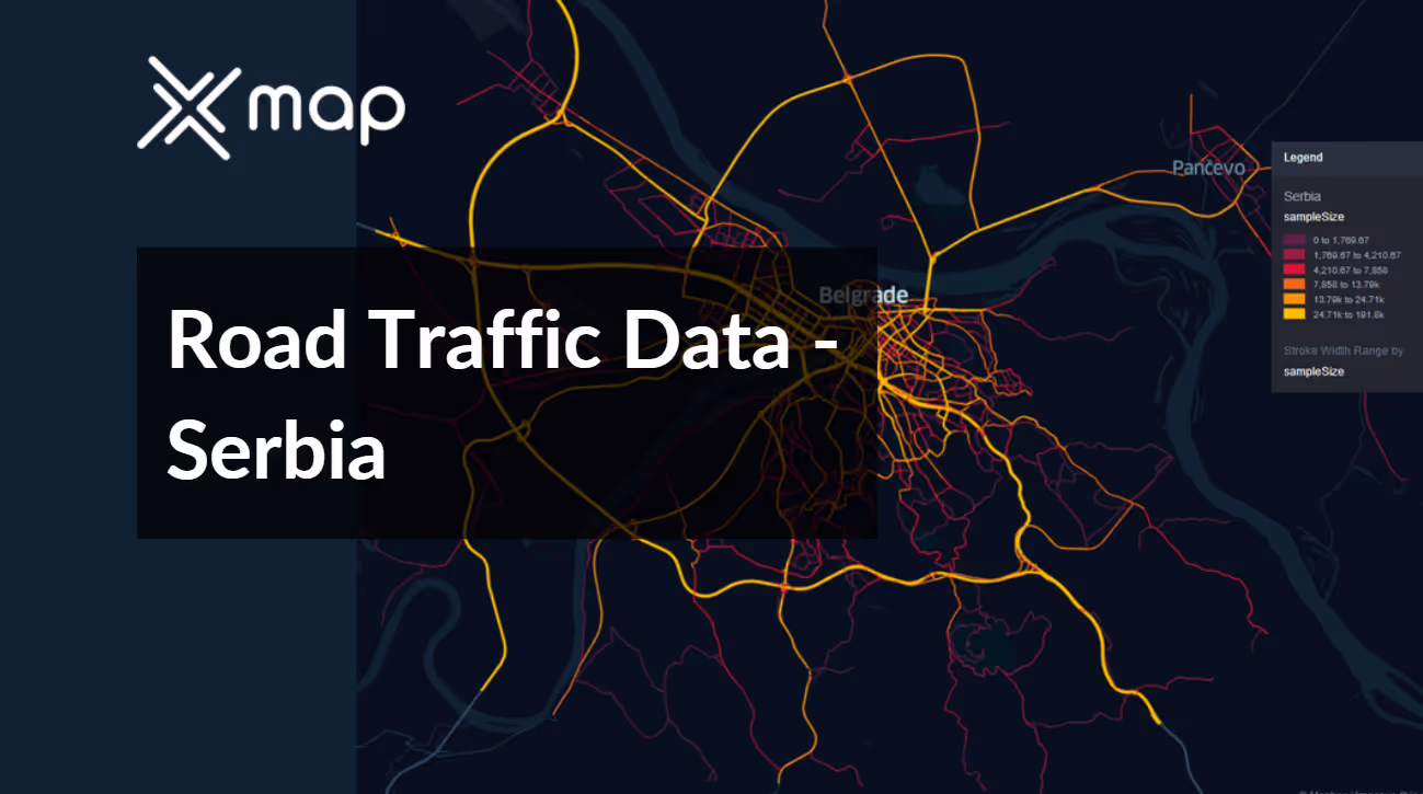


Vital Traffic Insights across the Serbia
Delve into detailed data and studies to uncover valuable insights into the complexities of traffic flow, congested areas, and necessary speed modifications, aiding in efficient transportation planning throughout Serbia.
Download a Sample
Preview the depth and breadth of our traffic data collection, showcasing how granular insights can revolutionize transportation planning and management in Serbia.
.avif)
Key Variables
Delve into detailed data and studies to uncover valuable insights into the complexities of traffic flow, congested areas, and necessary speed modifications, aiding in efficient transportation planning throughout Serbia.
Use Cases
How can this dataset benefit you?
Utilize Serbia's road traffic data to manage and alleviate urban congestion in Belgrade. Implement intelligent traffic systems that adjust traffic signal timings in real-time based on current traffic conditions. Additionally, use data to plan and promote alternative transportation modes such as cycling and public transit, especially during peak hours, to reduce congestion and enhance urban mobility.
Leverage traffic flow and congestion data to prioritize and plan road infrastructure improvements and expansions in key areas across Serbia. Focus on regions with high traffic volumes and frequent bottlenecks to enhance road capacity and efficiency. This strategic planning helps in reducing traffic jams, improving travel times, and supporting economic growth by facilitating smoother transportation of goods and services.
Employ road traffic and accident data to identify high-risk zones on rural and mountainous roads in Serbia. Implement targeted safety measures such as better road markings, improved lighting, and enhanced signage. Additionally, initiate driver awareness campaigns focused on safe driving practices in these high-risk areas to reduce accident rates and improve overall road safety.
Everything You need to know to know about the Road Traffic of Serbia
Median Vehicle Speeds by Road Names
This analysis evaluates median vehicle speeds across different road types, highlighting efficiency and congestion levels from highways to local streets.
Speed Limit Distribution
Explores the range and prevalence of speed limits throughout Serbia, identifying areas with strict regulations and potential zones for speed limit adjustments.

Functional Road Class (FRC) Distribution
Illustrates the variety of road types within the network, from major thoroughfares to local streets, and their distribution across the territory.

Average Speed by Functional Road Class (FRC)
Analyzes average speeds based on road functional classifications, providing insights into traffic flow and congestion differences between arterial roads and local streets.

Average Speed Distribution for Зрењанински пут
Examines speed patterns along this major road, highlighting areas of congestion or high efficiency and their impact on travel times.

Top 10 Streets by Average Speed
Lists the top 10 streets by average speed, offering an overview of traffic conditions in busy urban areas or on efficient routes.

Serbia Street Traffic Analysis
Presents a detailed examination of traffic flow on Serbia’s streets, including peak traffic times, average speeds, and congested areas, supported by visual data.

Why xMap?
xMap empowers businesses with unparalleled location intelligence and comprehensive data analysis, guiding them towards market leadership and growth.
Frequently Asked Questions
Find answers to commonly asked questions about our spatial analyst platform.
This dataset encompasses real-time and historical data on traffic density, accidents, road conditions, and congestion trends.
Leverage this dataset for site selection, analyze road traffic on your desired business location, enhanced route planning, strategic urban development projects, and to implement proactive traffic management strategies.
At xMap, we are committed to ensuring that our clients can leverage our datasets effectively. We provide comprehensive technical support, including help with data integration, troubleshooting, and optimization of data use. Additionally, we offer consulting services to help businesses understand and analyze traffic data to meet their specific strategic objectives.

