Poland - Road Traffic Data
Explore the intricate dynamics of Poland's roadways with our comprehensive traffic dataset, which offers rich insights into traffic volumes, congestion patterns, and travel behaviors across urban and rural settings. Ideal for government agencies, city planners, and transportation companies, this dataset is instrumental in developing efficient traffic management solutions, enhancing public transportation systems, and guiding infrastructural developments throughout Poland.
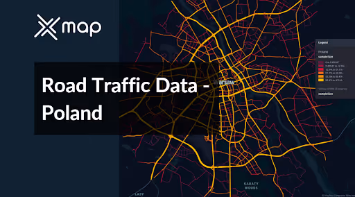


Vital Traffic Insights across the Poland
Examine in-depth information and studies that provide insights into the complexities of traffic patterns, areas with heavy traffic, and changes in speed needed for making well-informed decisions when organizing transportation in Poland.
Download a Sample
Preview the depth and breadth of our traffic data collection, showcasing how granular insights can revolutionize transportation planning and management in Poland.
.avif)
Key Variables
Examine in-depth information and studies that provide insights into the complexities of traffic patterns, areas with heavy traffic, and changes in speed needed for making well-informed decisions when organizing transportation in Poland.
Use Cases
How can this dataset benefit you?
Utilize the road traffic data from Poland to optimize traffic flows in major urban centers such as Warsaw, Krakow, and Gdansk. Implement advanced traffic management systems that use real-time data to adjust traffic light sequences, manage lane usage, and provide drivers with dynamic routing suggestions, reducing congestion and enhancing the efficiency of urban transportation networks.
Leverage traffic and commuter pattern data to strategically plan expansions of the public transport network, particularly focusing on areas with insufficient service coverage and high commuter demand. Use this information to decide where to extend tram and bus lines, or to introduce new routes, improving accessibility and encouraging a shift from private car use to public transport.
Employ traffic data to identify accident-prone areas and develop targeted road safety improvement programs. Initiatives could include the installation of better road signage, application of anti-skid surfaces, and adjustments to road design. Additionally, use the data to tailor educational campaigns aimed at reducing risky driving behaviors, ultimately decreasing the frequency and severity of traffic accidents.
Everything You need to know to know about the Road Traffic of Poland
Median Vehicle Speeds by Road Names
This analysis evaluates median vehicle speeds across various road types, highlighting efficiency and congestion levels from highways to local streets.
Speed Limit Distribution
Explores the range and prevalence of speed limits throughout Poland, identifying areas with strict regulations and potential zones for speed limit adjustments.

Functional Road Class (FRC) Distribution
Illustrates the variety of road types within the network, from major thoroughfares to local streets, and their distribution across the territory.

Average Speed by Functional Road Class (FRC)
Analyzes average speeds based on road functional classifications, providing insights into traffic flow and congestion differences between arterial roads and local streets.

Average Speed Distribution for Puławska
Examines speed patterns along this major road, highlighting areas of congestion or high efficiency and their impact on travel times.

Top 10 Streets by Average Speed
Lists the top 10 streets by average speed, offering an overview of traffic conditions in busy urban areas or on efficient routes.

Warsaw Street Traffic Analysis
Presents a detailed examination of traffic flow on Warsaw’s streets, including peak traffic times, average speeds, and congested areas, supported by visual data.

Why xMap?
xMap empowers businesses with unparalleled location intelligence and comprehensive data analysis, guiding them towards market leadership and growth.
Frequently Asked Questions
Find answers to commonly asked questions about our spatial analyst platform.
This dataset encompasses real-time and historical data on traffic density, accidents, road conditions, and congestion trends.
Leverage this dataset for site selection, analyze road traffic on your desired business location, enhanced route planning, strategic urban development projects, and to implement proactive traffic management strategies.
At xMap, we are committed to ensuring that our clients can leverage our datasets effectively. We provide comprehensive technical support, including help with data integration, troubleshooting, and optimization of data use. Additionally, we offer consulting services to help businesses understand and analyze traffic data to meet their specific strategic objectives.

