Philippines - Road Traffic Data
Navigate the complexities of the Philippines' road networks with our extensive traffic dataset, capturing detailed insights into traffic flows, congestion levels, and vehicle types across metropolitan hubs and provincial roads. Essential for policymakers, urban planners, and transportation developers, this dataset is pivotal for crafting effective traffic management strategies, optimizing public transportation routes, and driving infrastructural enhancements throughout the Philippines.
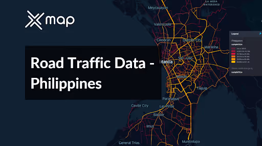


Vital Traffic Insights across the Philippines
Examine in-depth data and studies that illuminate the complexities of traffic patterns, congested zones, and changes in speed essential for making well-informed decisions in the planning of transportation in the Philippines.
Download a Sample
Preview the depth and breadth of our traffic data collection, showcasing how granular insights can revolutionize transportation planning and management in Philippines.
.avif)
Key Variables
Examine in-depth data and studies that illuminate the complexities of traffic patterns, congested zones, and changes in speed essential for making well-informed decisions in the planning of transportation in the Philippines.
Use Cases
How can this dataset benefit you?
Utilize the Philippines' road traffic data to tackle congestion in Metro Manila, one of the most densely populated urban areas in the world. Implement data-driven traffic management systems that adjust signal timings in real-time, introduce congestion charges in highly trafficked areas, and optimize public transit routes to alleviate daily traffic jams and reduce travel times for millions of commuters.
Leverage traffic data to enhance disaster response and evacuation planning in areas prone to natural disasters, such as typhoons and volcanic eruptions. Use traffic flow patterns to plan optimal evacuation routes, ensure clear pathways for emergency vehicles, and establish temporary shelters accessible via less congested routes, significantly improving the safety and efficiency of emergency operations.
Employ road traffic data to support smart city initiatives in rapidly growing cities like Cebu and Davao. Integrate traffic data with IoT devices to monitor and manage traffic lights and digital signage, provide real-time parking and traffic information to drivers via mobile apps, and analyze traffic patterns to plan future urban development that accommodates growth without escalating congestion.
Everything You need to know to know about the Road Traffic of Philippines
Median Vehicle Speeds by Road Names
This analysis evaluates median vehicle speeds across different road types, highlighting efficiency and congestion levels from highways to local streets.
Speed Limit Distribution
Explores the range and prevalence of speed limits throughout the Philippines, identifying areas with strict regulations and potential zones for speed limit adjustments.

Functional Road Class (FRC) Distribution
Illustrates the variety of road types within the network, from major thoroughfares to local streets, and their distribution across the territory.

Average Speed by Functional Road Class (FRC)
Analyzes average speeds based on road functional classifications, providing insights into traffic flow and congestion differences between arterial roads and local streets.

Average Speed Distribution for Alabang-Zapote Road
Examines speed patterns along this major road, highlighting areas of congestion or high efficiency and their impact on travel times.

Top 10 Streets by Average Speed
Lists the top 10 streets by average speed, offering an overview of traffic conditions in busy urban areas or on efficient routes.

Manila Street Traffic Analysis
Presents a detailed examination of traffic flow on Manila's streets, including peak traffic times, average speeds, and congested areas, supported by visual data.

Why xMap?
xMap empowers businesses with unparalleled location intelligence and comprehensive data analysis, guiding them towards market leadership and growth.
Frequently Asked Questions
Find answers to commonly asked questions about our spatial analyst platform.
This dataset encompasses real-time and historical data on traffic density, accidents, road conditions, and congestion trends.
Leverage this dataset for site selection, analyze road traffic on your desired business location, enhanced route planning, strategic urban development projects, and to implement proactive traffic management strategies.
At xMap, we are committed to ensuring that our clients can leverage our datasets effectively. We provide comprehensive technical support, including help with data integration, troubleshooting, and optimization of data use. Additionally, we offer consulting services to help businesses understand and analyze traffic data to meet their specific strategic objectives.

