Peru - Road Traffic Data
Dive into the dynamic flow of Peru’s diverse roadways with our comprehensive traffic dataset, offering crucial insights into traffic volumes, congestion trends, and vehicle types from the bustling streets of Lima to the winding roads of the Andes. Essential for government bodies, urban planners, and transportation companies, this dataset facilitates informed decision-making to enhance traffic management, improve public transportation systems, and support infrastructure development across Peru.
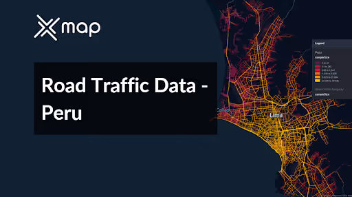


Vital Traffic Insights across the Peru
Examine in-depth data and studies that provide insight into the complexities of traffic patterns, congested zones, and variations in speed crucial for well-informed choices in organizing transportation in Peru.
Download a Sample
Preview the depth and breadth of our traffic data collection, showcasing how granular insights can revolutionize transportation planning and management in Peru.
.avif)
Key Variables
Examine in-depth data and studies that provide insight into the complexities of traffic patterns, congested zones, and variations in speed crucial for well-informed choices in organizing transportation in Peru.
Use Cases
How can this dataset benefit you?
Utilize Peru's road traffic data to develop and implement congestion mitigation strategies in Lima, Peru's capital and largest city. Techniques might include optimizing traffic signal timings based on real-time data, implementing congestion pricing in high-traffic areas, and promoting alternate transport methods such as cycling and public transit during peak hours to alleviate congestion and improve air quality.
Leverage traffic data to manage and optimize the flow of vehicles in tourist-heavy areas like Cusco and the route to Machu Picchu. Use insights from the data to design effective traffic routing and parking solutions, especially during peak tourist seasons, ensuring a smooth and sustainable experience for visitors while preserving the integrity of historic sites.
Employ road traffic data to enhance road safety and infrastructure planning across Peru, particularly in areas prone to accidents and high traffic volumes. Analyze data to identify dangerous road sections and implement safety measures such as better road signage, improved lighting, and speed cameras. This data-driven approach helps prioritize infrastructure upgrades and maintenance, ensuring safer travel for all road users.
Everything You need to know to know about the Road Traffic of Peru
Median Vehicle Speeds by Road Names
This assessment evaluates the median vehicle speeds across various road types, emphasizing efficiency and congestion levels from highways to local streets.
Speed Limit Distribution
Investigates the range and prevalence of speed limits throughout Peru, pinpointing areas with strict regulations and identifying potential zones for speed limit adjustments.

Functional Road Class (FRC) Distribution
Demonstrates the variety of road types within the network, ranging from major thoroughfares to local streets, and illustrates their distribution across the territory.

Average Speed by Functional Road Class (FRC)
Analyzes average speeds categorized by road functional classifications, offering insights into traffic flow and congestion differences between arterial roads and local streets.

Average Speed Distribution for Carretera Panamericana Norte
Examines speed patterns along this major road, highlighting areas of congestion or high efficiency and their impact on travel times.

Top 10 Streets by Average Speed
Provides a list of the top 10 streets by average speed, giving an overview of traffic conditions in bustling urban areas or along efficient routes.

Lima Street Traffic Analysis
Presents a detailed examination of traffic flow on Lima's streets, including peak traffic times, average speeds, and congested areas, supported by visual data.

Why xMap?
xMap empowers businesses with unparalleled location intelligence and comprehensive data analysis, guiding them towards market leadership and growth.
Frequently Asked Questions
Find answers to commonly asked questions about our spatial analyst platform.
This dataset encompasses real-time and historical data on traffic density, accidents, road conditions, and congestion trends.
Leverage this dataset for site selection, analyze road traffic on your desired business location, enhanced route planning, strategic urban development projects, and to implement proactive traffic management strategies.
At xMap, we are committed to ensuring that our clients can leverage our datasets effectively. We provide comprehensive technical support, including help with data integration, troubleshooting, and optimization of data use. Additionally, we offer consulting services to help businesses understand and analyze traffic data to meet their specific strategic objectives.

