Norway - Road Traffic Data
Study a vast collection of data that shows the intricate connections between road usage, traffic congestion, and patterns in traffic in Norway. Utilize this extensive data to gather crucial insights for your strategic planning through a comprehensive analysis of traffic flow nationwide.
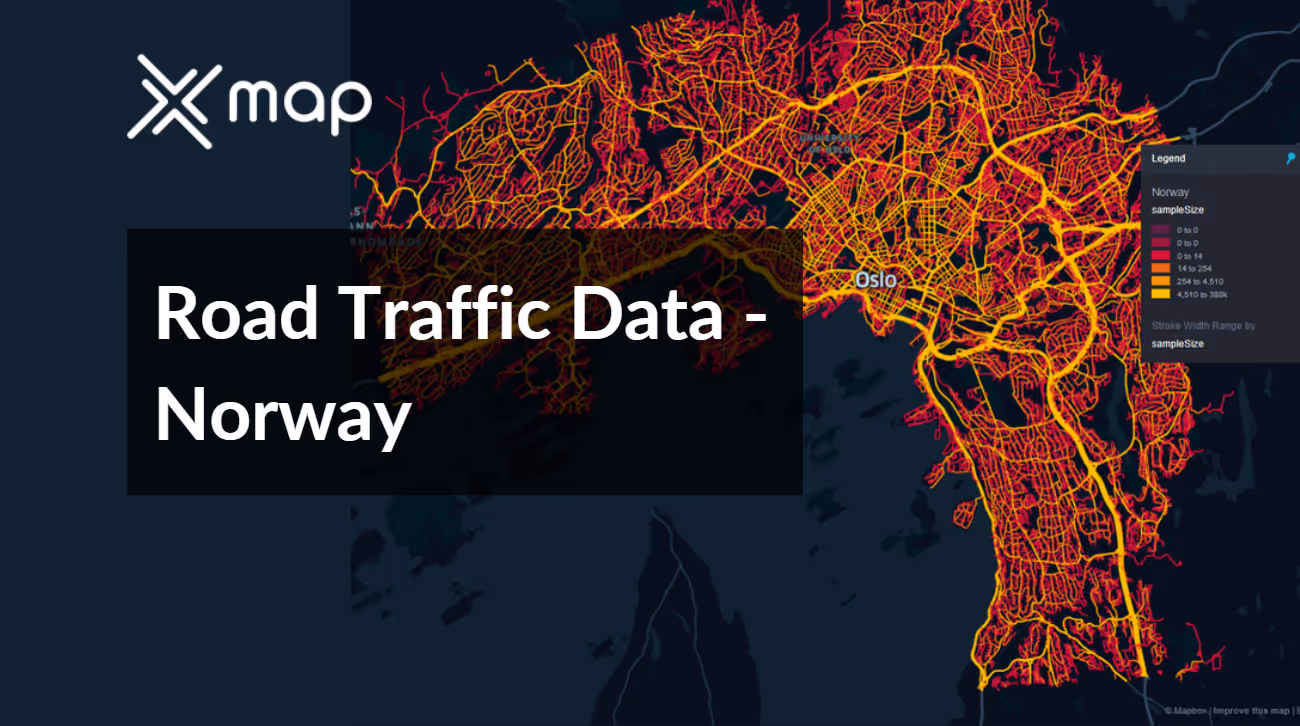


Vital Traffic Insights across the Norway
Examine in-depth data and analysis to provide insight into the complexities of traffic flow, congested zones, and speed variations crucial for making informed decisions in transportation planning in Norway.
Download a Sample
Preview the depth and breadth of our traffic data collection, showcasing how granular insights can revolutionize transportation planning and management in Norway.
.avif)
Key Variables
Examine in-depth data and analysis to provide insight into the complexities of traffic flow, congested zones, and speed variations crucial for making informed decisions in transportation planning in Norway.
Use Cases
How can this dataset benefit you?
Utilize Norway's road traffic data to enhance road safety during the harsh winter months. Analyze traffic patterns and accident hotspots to prioritize snow removal and de-icing efforts. Implement dynamic signage that adjusts warnings based on real-time weather and traffic conditions, significantly reducing winter travel hazards for drivers.
Leverage traffic flow data to strategically plan and expand the network of electric vehicle (EV) charging stations across Norway, a leader in electric vehicle adoption. Use insights from traffic volumes and vehicle types to identify optimal locations for new charging stations, facilitating more efficient and accessible charging solutions that encourage further adoption of EVs.
Employ road traffic data in conjunction with IoT technologies to create a smart city traffic management system in Oslo. This system would use real-time data analytics to manage traffic flow, control traffic lights, and provide drivers with real-time information on traffic conditions and parking availability. The aim is to improve urban mobility, reduce congestion, and decrease emissions in the city center.
Everything You need to know to know about the Road Traffic of Norway
Median Vehicle Speeds by Road Names
This assessment evaluates median vehicle speeds across various road types, emphasizing efficiency and congestion levels from highways to local streets.
Speed Limit Distribution
Investigates the range and prevalence of speed limits throughout Norway, pinpointing areas with strict regulations and potential zones for speed limit adjustments.

Functional Road Class (FRC) Distribution
Demonstrates the variety of road types within the network, spanning from major thoroughfares to local streets, and their distribution across the territory.

Average Speed by Functional Road Class (FRC)
Examines average speeds categorized by road functional classifications, offering insights into traffic flow and congestion disparities between arterial roads and local streets.

Average Speed Distribution for Mosseveien
Analyzes speed patterns along this major road, highlighting congested areas or high efficiency spots and their impact on travel times.

Top 10 Streets by Average Speed
Provides a list of the top 10 streets by average speed, giving an overview of traffic conditions in bustling urban areas or along efficient routes.

Oslo Street Traffic Analysis
Delivers a comprehensive examination of traffic flow on Oslo's streets, including peak traffic times, average speeds, and congested areas, supported by visual data.

Why xMap?
xMap empowers businesses with unparalleled location intelligence and comprehensive data analysis, guiding them towards market leadership and growth.
Frequently Asked Questions
Find answers to commonly asked questions about our spatial analyst platform.
This dataset encompasses real-time and historical data on traffic density, accidents, road conditions, and congestion trends.
Leverage this dataset for site selection, analyze road traffic on your desired business location, enhanced route planning, strategic urban development projects, and to implement proactive traffic management strategies.
At xMap, we are committed to ensuring that our clients can leverage our datasets effectively. We provide comprehensive technical support, including help with data integration, troubleshooting, and optimization of data use. Additionally, we offer consulting services to help businesses understand and analyze traffic data to meet their specific strategic objectives.

