Namibia - Road Traffic Data
Explore the vast landscapes of Namibia with our comprehensive road traffic dataset, which captures essential insights into traffic flows, congestion levels, and travel patterns across both urban centers and remote areas. Ideal for government bodies, urban planners, and transportation companies, this dataset is pivotal for improving road safety, enhancing traffic management strategies, and planning future infrastructure projects throughout Namibia.
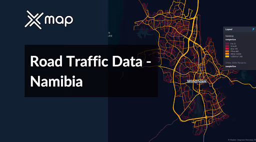


Vital Traffic Insights across the Namibia
Analyze detailed data and research that sheds light on the intricacies of traffic flow, congested areas, and fluctuations in speed necessary for informed decision-making in planning transportation in Namibia.
Download a Sample
Preview the depth and breadth of our traffic data collection, showcasing how granular insights can revolutionize transportation planning and management in Namibia.
.avif)
Key Variables
Analyze detailed data and research that sheds light on the intricacies of traffic flow, congested areas, and fluctuations in speed necessary for informed decision-making in planning transportation in Namibia.
Use Cases
How can this dataset benefit you?
Utilize Namibia's road traffic data to identify and target high-risk areas for road accidents, particularly on long, rural roads that are prone to high-speed collisions. Implement targeted safety measures such as improved road signage, enhanced lighting, and speed reduction campaigns. Additionally, analyze data to optimize the placement and timing of road safety awareness campaigns to reduce accident rates and enhance driver safety.
Leverage traffic data to optimize tourism routes, especially in regions leading to key attractions like Etosha National Park and the Skeleton Coast. Use insights from the data to manage and direct traffic flows during peak tourist seasons, ensuring smoother travel experiences for visitors and minimizing environmental impact on sensitive areas.
Employ traffic flow data to alleviate urban congestion in growing cities such as Windhoek. Analyze patterns of congestion to implement effective solutions such as traffic signal optimization, the introduction of one-way streets, or the expansion of public transport services. These strategies aim to improve urban mobility, reduce travel times, and lower emissions from idling vehicles.
Everything You need to know to know about the Road Traffic of Namibia
Median Vehicle Speeds by Road Names
This analysis evaluates median vehicle speeds across various road types, highlighting efficiency and congestion levels from highways to local streets.
Speed Limit Distribution
Explores the range and prevalence of speed limits throughout Namibia, identifying areas with strict regulations and potential zones for speed limit adjustments.

Functional Road Class (FRC) Distribution
Illustrates the variety of road types within the network, from major thoroughfares to local streets, and their distribution across the territory.

Average Speed by Functional Road Class (FRC)
Analyzes average speeds based on road functional classifications, providing insights into traffic flow and congestion differences between arterial roads and local streets.

Average Speed Distribution for Sam Nujoma Drive
Examines speed patterns along this major road, highlighting areas of congestion or high efficiency and their impact on travel times.

Top 10 Streets by Average Speed
Lists the top 10 streets by average speed, offering an overview of traffic conditions in busy urban areas or on efficient routes.

Windhoek Street Traffic Analysis
Presents a detailed examination of traffic flow on Windhoek's streets, including peak traffic times, average speeds, and congested areas, supported by visual data.

Why xMap?
xMap empowers businesses with unparalleled location intelligence and comprehensive data analysis, guiding them towards market leadership and growth.
Frequently Asked Questions
Find answers to commonly asked questions about our spatial analyst platform.
This dataset encompasses real-time and historical data on traffic density, accidents, road conditions, and congestion trends.
Leverage this dataset for site selection, analyze road traffic on your desired business location, enhanced route planning, strategic urban development projects, and to implement proactive traffic management strategies.
At xMap, we are committed to ensuring that our clients can leverage our datasets effectively. We provide comprehensive technical support, including help with data integration, troubleshooting, and optimization of data use. Additionally, we offer consulting services to help businesses understand and analyze traffic data to meet their specific strategic objectives.

