Mozambique - Road Traffic Data
Dive into the complexities of Mozambique’s road networks with our detailed traffic dataset, which provides vital insights into traffic volumes, congestion patterns, and seasonal variations across key urban and rural routes. Essential for transportation planners, government officials, and infrastructure developers, this dataset facilitates strategic decision-making to enhance road safety, optimize traffic management, and support sustainable urban development initiatives throughout Mozambique.
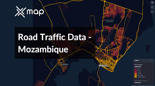


Vital Traffic Insights across the Mozambique
Examine in-depth information and studies that illuminate the complexities of traffic movement, areas of congestion, and changes in speed that are essential for making well-informed decisions when organizing transportation in Mozambique.
Download a Sample
Preview the depth and breadth of our traffic data collection, showcasing how granular insights can revolutionize transportation planning and management in Mozambique.
Key Variables
Examine in-depth information and studies that illuminate the complexities of traffic movement, areas of congestion, and changes in speed that are essential for making well-informed decisions when organizing transportation in Mozambique.
Use Cases
How can this dataset benefit you?
Utilize Mozambique's road traffic data to identify high-risk areas prone to accidents and congestion. Implement targeted safety measures such as better road signage, enhanced lighting, and pedestrian crossings. Additionally, initiate public safety campaigns to raise awareness about road safety measures, significantly reducing accident rates and enhancing safety for all road users.
Leverage traffic data to optimize logistics and freight management across Mozambique, especially for routes that are critical for the transport of goods to and from major ports like Maputo. Analyze traffic flow patterns to determine the most efficient times and routes for transportation, reducing delivery times, lowering fuel costs, and minimizing wear and tear on vehicles.
Use traffic volume and congestion data to inform urban planning and infrastructure development in rapidly growing cities like Beira and Nampula. Prioritize infrastructure projects such as road widening, the creation of new bypasses, or the installation of traffic management systems based on actual traffic needs. This strategic planning helps accommodate current traffic demands and anticipates future growth, ensuring sustainable urban development.
Everything You need to know to know about the Road Traffic of Mozambique
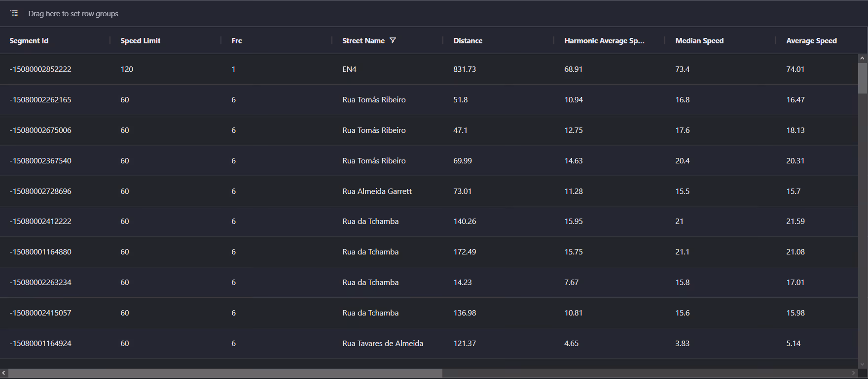
Median Vehicle Speeds by Road Names
This analysis assesses median vehicle speeds across different road types, highlighting efficiency and congestion levels from highways to local streets.
Speed Limit Distribution
Explores the range and prevalence of speed limits throughout Mozambique, identifying areas with strict regulations and potential zones for speed limit adjustments.

Functional Road Class (FRC) Distribution
Illustrates the variety of road types within the network, from major thoroughfares to local streets, and their distribution across the territory.

Average Speed by Functional Road Class (FRC)
Analyzes average speeds based on road functional classifications, providing insights into traffic flow and congestion differences between arterial roads and local streets.

Average Speed Distribution for Avenida de Mozambique
Examines speed patterns along this major road, highlighting areas of congestion or high efficiency and their impact on travel times.

Top 10 Streets by Average Speed
Lists the top 10 streets by average speed, offering an overview of traffic conditions in busy urban areas or on efficient routes.

Maputo Street Traffic Analysis
Presents a detailed examination of traffic flow on Maputo's streets, including peak traffic times, average speeds, and congested areas, supported by visual data.

Why xMap?
xMap empowers businesses with unparalleled location intelligence and comprehensive data analysis, guiding them towards market leadership and growth.
Frequently Asked Questions
Find answers to commonly asked questions about our spatial analyst platform.
This dataset encompasses real-time and historical data on traffic density, accidents, road conditions, and congestion trends.
Leverage this dataset for site selection, analyze road traffic on your desired business location, enhanced route planning, strategic urban development projects, and to implement proactive traffic management strategies.
At xMap, we are committed to ensuring that our clients can leverage our datasets effectively. We provide comprehensive technical support, including help with data integration, troubleshooting, and optimization of data use. Additionally, we offer consulting services to help businesses understand and analyze traffic data to meet their specific strategic objectives.

