Monaco - Road Traffic Data
Navigate the intricate traffic dynamics of Monaco with our detailed dataset, capturing essential information on traffic flows, congestion trends, and vehicle types within this compact urban state. Perfect for local authorities, urban planners, and businesses, this dataset provides the insights needed to enhance traffic management, optimize urban mobility, and support sustainable development initiatives in one of the world's most densely populated areas.
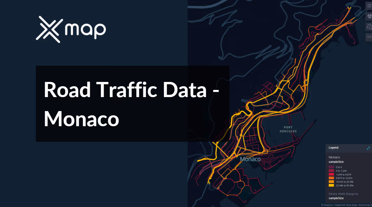


Vital Traffic Insights across the Monaco
Review detailed data and research highlighting the intricacies of traffic flow, congestion hotspots, and speed fluctuations crucial for informed decision-making in coordinating transportation across Monaco.
Download a Sample
Preview the depth and breadth of our traffic data collection, showcasing how granular insights can revolutionize transportation planning and management in Monaco.
.avif)
Key Variables
Review detailed data and research highlighting the intricacies of traffic flow, congestion hotspots, and speed fluctuations crucial for informed decision-making in coordinating transportation across Monaco.
Use Cases
How can this dataset benefit you?
Utilize Monaco’s road traffic data to manage and optimize traffic flow during major events such as the Monaco Grand Prix or the Yacht Show. Implement real-time traffic monitoring and control systems to adjust traffic patterns dynamically, ensuring smooth ingress and egress for attendees while minimizing disruption to local residents.
Leverage traffic data to analyze the flow and density near luxury retail districts in Monaco. Use this information to optimize store opening hours, promotional events, and valet parking services to coincide with peak traffic times, enhancing the shopping experience for high-end consumers and increasing business for retailers.
Employ traffic data to plan and implement strategies that reduce the environmental impact of vehicular traffic in Monaco. Initiatives could include optimizing public transit routes to reduce redundancy, expanding pedestrian zones, and encouraging the use of electric vehicles through targeted incentives and infrastructure support like increased charging stations.
Everything You need to know to know about the Road Traffic of Monaco
Median Vehicle Speeds by Road Names
This analysis evaluates median vehicle speeds across various road types, highlighting efficiency and congestion levels from highways to local streets.
Speed Limit Distribution
Explores the range and prevalence of speed limits throughout Monaco, identifying areas with strict regulations and potential zones for speed limit adjustments.

Functional Road Class (FRC) Distribution
Illustrates the variety of road types within the network, from major thoroughfares to local streets, and their distribution across the territory.

Average Speed by Functional Road Class (FRC)
Analyzes average speeds based on road functional classifications, providing insights into traffic flow and congestion differences between arterial roads and local streets.

Average Speed Distribution for Boulevard du Larvotto
Examines speed patterns along this major road, highlighting areas of congestion or high efficiency and their impact on travel times.

Top 10 Streets by Average Speed
Lists the top 10 streets by average speed, offering an overview of traffic conditions in busy urban areas or on efficient routes.

Monaco Street Traffic Analysis
Presents a detailed examination of traffic flow on Monaco's streets, including peak traffic times, average speeds, and congested areas, supported by visual data.

Why xMap?
xMap empowers businesses with unparalleled location intelligence and comprehensive data analysis, guiding them towards market leadership and growth.
Frequently Asked Questions
Find answers to commonly asked questions about our spatial analyst platform.
This dataset encompasses real-time and historical data on traffic density, accidents, road conditions, and congestion trends.
Leverage this dataset for site selection, analyze road traffic on your desired business location, enhanced route planning, strategic urban development projects, and to implement proactive traffic management strategies.
At xMap, we are committed to ensuring that our clients can leverage our datasets effectively. We provide comprehensive technical support, including help with data integration, troubleshooting, and optimization of data use. Additionally, we offer consulting services to help businesses understand and analyze traffic data to meet their specific strategic objectives.

