Malta - Road Traffic Data
Dive into the intricacies of Malta’s road networks with our detailed traffic dataset, which offers insights into traffic flows, congestion patterns, and seasonal traffic fluctuations across this densely populated island nation. Essential for urban planners, traffic authorities, and businesses, this dataset facilitates strategic decision-making for traffic management, infrastructure development, and enhancing mobility solutions throughout Malta.
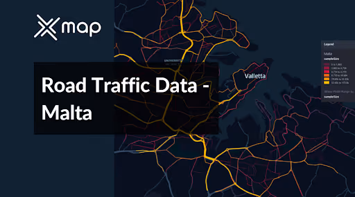


Vital Traffic Insights across the Malta
Analyze in-depth data and research that demonstrate the intricacies of traffic circulation, congested areas, and speed variations—crucial for making well-informed choices in transportation planning and management across Malta.
Download a Sample
Preview the depth and breadth of our traffic data collection, showcasing how granular insights can revolutionize transportation planning and management in Malta.
.avif)
Key Variables
Analyze in-depth data and research that demonstrate the intricacies of traffic circulation, congested areas, and speed variations—crucial for making well-informed choices in transportation planning and management across Malta.
Use Cases
How can this dataset benefit you?
Utilize Malta’s road traffic data to develop integrated congestion management strategies aimed at reducing traffic bottlenecks in densely populated areas, particularly in and around Valletta. Implement solutions such as congestion pricing, optimized traffic light timings, and incentives for off-peak travel to improve traffic flow and reduce travel times.
Leverage traffic flow and density data to enhance Malta’s public transport network. Identify under-serviced routes and areas with high traffic congestion to optimize bus routes and schedules. This targeted improvement can increase public transport usage, reduce dependence on private vehicles, and ultimately decrease overall congestion.
Analyze traffic accident data and identify high-risk areas across Malta. Use this information to implement targeted safety measures, such as improved street lighting, enhanced road markings, and traffic calming devices. Additionally, launch road safety awareness campaigns focusing on these high-risk areas to educate the public and reduce accident rates.
Everything You need to know to know about the Road Traffic of Malta
Median Vehicle Speeds by Road Names
This analysis examines median vehicle speeds across different road types, highlighting efficiency and congestion levels from highways to local streets.
Speed Limit Distribution
Explores the range and prevalence of speed limits throughout Malta, identifying areas with strict regulations and potential zones for speed limit adjustments.

Functional Road Class (FRC) Distribution
Illustrates the variety of road types within the network, from major thoroughfares to local streets, and their distribution across the territory.

Average Speed by Functional Road Class (FRC)
Analyzes average speeds based on road functional classifications, providing insights into traffic flow and congestion differences between arterial roads and local streets.

Average Speed Distribution for Triq Mikiel Anton Vassalli
Examines speed patterns along this major road, highlighting areas of congestion or high efficiency and their impact on travel times.

Top 10 Streets by Average Speed
Lists the top 10 streets by average speed, offering an overview of traffic conditions in busy urban areas or on efficient routes.

Valletta Street Traffic Analysis
Presents a detailed examination of traffic flow on Valletta's streets, including peak traffic times, average speeds, and congested areas, supported by visual data.

Why xMap?
xMap empowers businesses with unparalleled location intelligence and comprehensive data analysis, guiding them towards market leadership and growth.
Frequently Asked Questions
Find answers to commonly asked questions about our spatial analyst platform.
This dataset encompasses real-time and historical data on traffic density, accidents, road conditions, and congestion trends.
Leverage this dataset for site selection, analyze road traffic on your desired business location, enhanced route planning, strategic urban development projects, and to implement proactive traffic management strategies.
At xMap, we are committed to ensuring that our clients can leverage our datasets effectively. We provide comprehensive technical support, including help with data integration, troubleshooting, and optimization of data use. Additionally, we offer consulting services to help businesses understand and analyze traffic data to meet their specific strategic objectives.

