Luxembourg - Road Traffic Data
Explore the dynamic flow of Luxembourg’s roadways with our comprehensive traffic dataset, offering detailed insights into traffic patterns, congestion levels, and vehicle movements across this densely populated European hub. Essential for transportation planners, policymakers, and businesses, this dataset facilitates informed decision-making to streamline traffic management, enhance urban mobility, and support sustainable infrastructure projects throughout Luxembourg.
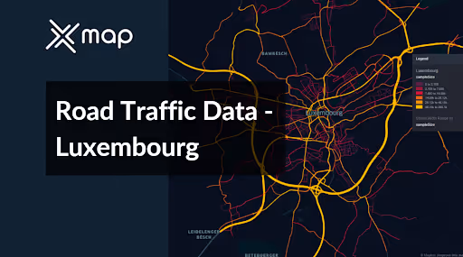


Vital Traffic Insights across the Luxembourg
Review extensive data and research that highlight the intricacies of traffic patterns, areas of congestion, and variations in speed—crucial for making well-informed choices in transportation planning and management across Luxembourg.
Download a Sample
Preview the depth and breadth of our traffic data collection, showcasing how granular insights can revolutionize transportation planning and management in Luxembourg.
.avif)
Key Variables
Review extensive data and research that highlight the intricacies of traffic patterns, areas of congestion, and variations in speed—crucial for making well-informed choices in transportation planning and management across Luxembourg.
Use Cases
How can this dataset benefit you?
Implement Luxembourg's road traffic data to manage congestion in busy urban areas, such as Luxembourg City. Utilize this data to design and enforce congestion charging zones to discourage unnecessary vehicle usage during peak hours, while simultaneously enhancing public transit options based on traffic flow insights.
Use traffic data to optimize Luxembourg’s public transport network. Analyze areas with heavy traffic congestion and high commuter density to adjust bus and tram routes, increase frequencies, and potentially introduce new lines. This will improve service reliability, encourage public transport use, and reduce traffic volumes.
Leverage traffic patterns to support eco-friendly urban planning in Luxembourg. Use the data to identify optimal locations for bike lanes and pedestrian paths, ensuring they connect key areas and provide viable alternatives to driving. This initiative would aim to reduce vehicle emissions, promote healthier lifestyles, and create more sustainable urban environments.
Everything You need to know to know about the Road Traffic of Luxembourg
Median Vehicle Speeds by Road Names
This analysis evaluates the median speeds of vehicles across various road types, highlighting efficiency and congestion levels from highways to local streets.
Speed Limit Distribution
Investigates the range and prevalence of speed limits throughout Luxembourg, pinpointing areas with strict regulations and potential zones for speed limit adjustments.

Functional Road Class (FRC) Distribution
Illustrates the variety of road types within the network, from major thoroughfares to local streets, and their distribution across the territory.

Average Speed by Functional Road Class (FRC)
Analyzes average speeds based on road functional classifications, providing insights into traffic flow and congestion differences between arterial roads and local streets.

Average Speed Distribution for Route d'Arlon
Examines speed patterns along this major road, highlighting areas of congestion or high efficiency and their impact on travel times.

Top 10 Streets by Average Speed
Lists the top 10 streets by average speed, offering an overview of traffic conditions in busy urban areas or on efficient routes.

Luxembourg City Street Traffic Analysis
Presents a detailed examination of traffic flow on Luxembourg City's streets, including peak traffic times, average speeds, and congested areas, supported by visual data.

Why xMap?
xMap empowers businesses with unparalleled location intelligence and comprehensive data analysis, guiding them towards market leadership and growth.
Frequently Asked Questions
Find answers to commonly asked questions about our spatial analyst platform.
This dataset encompasses real-time and historical data on traffic density, accidents, road conditions, and congestion trends.
Leverage this dataset for site selection, analyze road traffic on your desired business location, enhanced route planning, strategic urban development projects, and to implement proactive traffic management strategies.
Absolutely! Our dataset is designed for seamless integration with other xMap datasets. This allows for comprehensive multi-layered analysis, combining administrative boundaries with demographic, economic, and other relevant data sets for a holistic view.

