Lithuania - Road Traffic Data
Uncover the complexities of Lithuania’s road traffic with our detailed dataset, which provides comprehensive insights into traffic flows, congestion levels, and vehicle types across urban centers and rural routes. Essential for government agencies, urban planners, and transportation analysts, this dataset supports strategic decision-making to optimize traffic management, enhance public safety, and drive infrastructural advancements throughout Lithuania.


Vital Traffic Insights across the Lithuania
Analyze detailed data and research that uncover the intricacies of traffic patterns, congested areas, and changes in speed—vital for making informed choices in transportation planning and management across Lithuania.
Download a Sample
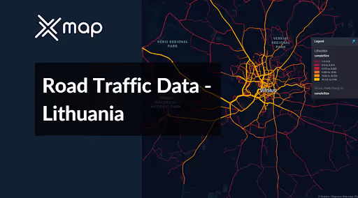
Preview the depth and breadth of our traffic data collection, showcasing how granular insights can revolutionize transportation planning and management in Lithuania.
.avif)
Key Variables
Analyze detailed data and research that uncover the intricacies of traffic patterns, congested areas, and changes in speed—vital for making informed choices in transportation planning and management across Lithuania.
Use Cases
How can this dataset benefit you?
Utilize Lithuania's road traffic data to optimize traffic flow in congested urban centers like Vilnius and Kaunas. Implement traffic management solutions such as adaptive traffic signal control systems that adjust based on real-time traffic conditions, reducing congestion and improving commute times for residents.
Leverage traffic volume and pattern analysis to inform infrastructure improvements and expansions in Lithuania. Prioritize projects such as road widening, new bypass creation, and intersection upgrades in areas identified as bottlenecks to enhance traffic flow and accommodate future growth.
Use detailed traffic and accident data to enhance road safety across Lithuania. Identify high-risk areas for accidents and implement targeted safety measures such as improved road signage, enhanced pedestrian crossings, and better road lighting. These improvements can significantly reduce the rate of traffic accidents and increase safety for all road users.
Everything You need to know to know about the Road Traffic of Lithuania
Median Vehicle Speeds by Road Names
This analysis examines median vehicle speeds across various road types, highlighting efficiency and congestion levels from highways to local streets.
Speed Limit Distribution
Explores the range and prevalence of speed limits throughout Lithuania, identifying areas with strict regulations and potential zones for speed limit adjustments.

Functional Road Class (FRC) Distribution
Depicts the variety of road types within the network, from major thoroughfares to local streets, and their distribution across the territory.

Average Speed by Functional Road Class (FRC)
Analyzes average speeds based on road functional classifications, offering insights into traffic flow and congestion differences between arterial roads and local streets.

Average Speed Distribution for Geležinio Vilko gatvė
Examines speed patterns along this major road, highlighting areas of congestion or high efficiency and their impact on travel times.

Top 10 Streets by Average Speed
Lists the top 10 streets by average speed, providing an overview of traffic conditions in busy urban areas or on efficient routes.

Vilnius Street Traffic Analysis
Presents a detailed examination of traffic flow on Vilnius's streets, including peak traffic times, average speeds, and congested areas, supported by visual data.

Why xMap?
xMap empowers businesses with unparalleled location intelligence and comprehensive data analysis, guiding them towards market leadership and growth.
Frequently Asked Questions
Find answers to commonly asked questions about our spatial analyst platform.
This dataset encompasses real-time and historical data on traffic density, accidents, road conditions, and congestion trends.
Leverage this dataset for site selection, analyze road traffic on your desired business location, enhanced route planning, strategic urban development projects, and to implement proactive traffic management strategies.
At xMap, we are committed to ensuring that our clients can leverage our datasets effectively. We provide comprehensive technical support, including help with data integration, troubleshooting, and optimization of data use. Additionally, we offer consulting services to help businesses understand and analyze traffic data to meet their specific strategic objectives.

