Liechtenstein - Road Traffic Data
Delve into the dynamics of Liechtenstein’s compact road network with our extensive traffic dataset, which offers deep insights into traffic volumes, patterns, and congestion hotspots across this small yet economically vibrant nation. Ideal for local authorities, urban planners, and businesses, this dataset aids in crafting effective traffic management strategies, promoting sustainable transport solutions, and planning future infrastructure developments in Liechtenstein.
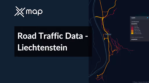


Vital Traffic Insights across the Liechtenstein
Analyze extensive information and research that highlight the intricacies of traffic patterns, congested areas, and changes in speed—critical for making well-informed choices in the management and planning of transportation across Liechtenstein.
Download a Sample
Preview the depth and breadth of our traffic data collection, showcasing how granular insights can revolutionize transportation planning and management in Liechtenstein.
.avif)
Key Variables
Analyze extensive information and research that highlight the intricacies of traffic patterns, congested areas, and changes in speed—critical for making well-informed choices in the management and planning of transportation across Liechtenstein.
Use Cases
How can this dataset benefit you?
Leverage Liechtenstein's road traffic data to efficiently manage cross-border traffic flows with neighboring countries, Switzerland and Austria. Use this information to coordinate with border control and customs to streamline processes, reduce waiting times, and ensure smooth transitions for commuters and goods, supporting the local economy and regional cooperation.
Utilize traffic data to support sustainable urban mobility initiatives in Liechtenstein, such as enhancing public transportation networks, expanding cycling paths, and promoting electric vehicle usage. By analyzing traffic congestion and commuter patterns, planners can identify areas where sustainable transport options can be effectively introduced or improved.`
Use traffic data to plan and coordinate large public events in Liechtenstein, such as national celebrations or international meetings. Analyze typical traffic flows and identify optimal routes and parking solutions to manage the increase in vehicles effectively, ensuring minimal disruption to the local traffic and enhancing the experience for attendees and residents alike.
Everything You need to know to know about the Road Traffic of Liechtenstein
Median Vehicle Speeds by Road Names
This analysis evaluates median vehicle speeds across various road types, highlighting efficiency and congestion levels from highways to local streets.
Speed Limit Distribution
Explores the range and prevalence of speed limits throughout Liechtenstein, identifying areas with strict regulations and potential zones for speed limit adjustments.

Functional Road Class (FRC) Distribution
Illustrates the variety of road types within the network, from major thoroughfares to local streets, and their distribution across the territory.

Average Speed by Functional Road Class (FRC)
Analyzes average speeds based on road functional classifications, providing insights into traffic flow and congestion differences between arterial roads and local streets.

Average Speed Distribution for Landstrasse
Examines speed patterns along this major road, highlighting areas of congestion or high efficiency and their impact on travel times.

Top 10 Streets by Average Speed
Lists the top 10 streets by average speed, offering an overview of traffic conditions in busy urban areas or on efficient routes.

Vaduz Street Traffic Analysis
Presents a detailed examination of traffic flow on Vaduz's streets, including peak traffic times, average speeds, and congested areas, supported by visual data.

Why xMap?
xMap empowers businesses with unparalleled location intelligence and comprehensive data analysis, guiding them towards market leadership and growth.
Frequently Asked Questions
Find answers to commonly asked questions about our spatial analyst platform.
This dataset encompasses real-time and historical data on traffic density, accidents, road conditions, and congestion trends.
Leverage this dataset for site selection, analyze road traffic on your desired business location, enhanced route planning, strategic urban development projects, and to implement proactive traffic management strategies.
At xMap, we are committed to ensuring that our clients can leverage our datasets effectively. We provide comprehensive technical support, including help with data integration, troubleshooting, and optimization of data use. Additionally, we offer consulting services to help businesses understand and analyze traffic data to meet their specific strategic objectives.

