Lesotho - Road Traffic Data
Explore the intricacies of Lesotho’s road networks with our detailed traffic dataset, offering valuable insights into traffic volumes, congestion patterns, and vehicle types across this mountainous kingdom. Essential for local government bodies, infrastructure developers, and transportation planners, this dataset supports informed decision-making to enhance road safety, improve urban mobility, and optimize traffic management throughout Lesotho.
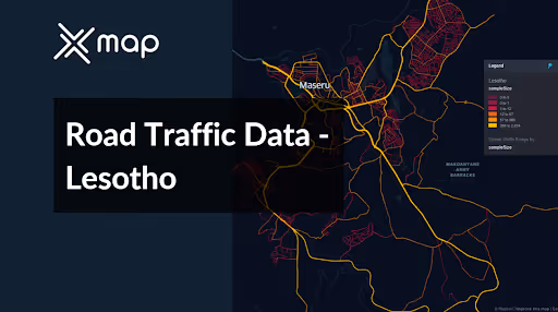


Vital Traffic Insights across the Lesotho
Examine detailed data and research that emphasize the complexities of traffic flow, congested zones, and speed fluctuations—essential for well-informed transportation planning and management in Lesotho.
Download a Sample
Preview the depth and breadth of our traffic data collection, showcasing how granular insights can revolutionize transportation planning and management in Lesotho.
Key Variables
Examine detailed data and research that emphasize the complexities of traffic flow, congested zones, and speed fluctuations—essential for well-informed transportation planning and management in Lesotho.
Use Cases
How can this dataset benefit you?
Utilize Lesotho's road traffic data to improve access and mobility in rural areas, which are often underserved by transportation infrastructure. Analyze traffic flow and vehicle types to prioritize road upgrades and the development of new routes that can enhance connectivity, boost local economies, and improve access to essential services.
Leverage traffic data to address urban congestion in Maseru, the capital city. Implement strategic interventions such as optimized traffic light sequencing, creation of one-way streets, or development of bypass routes to alleviate heavy traffic zones. This will enhance the efficiency of the urban transport network and reduce commute times for residents.
Use traffic patterns and congestion data to plan and optimize emergency response routes throughout Lesotho. Ensure that ambulances, fire services, and police can navigate quickly and efficiently in emergencies by identifying typically congested areas and times, and planning alternative routes or temporary traffic control measures to clear paths when needed.
Everything You need to know to know about the Road Traffic of Lesotho
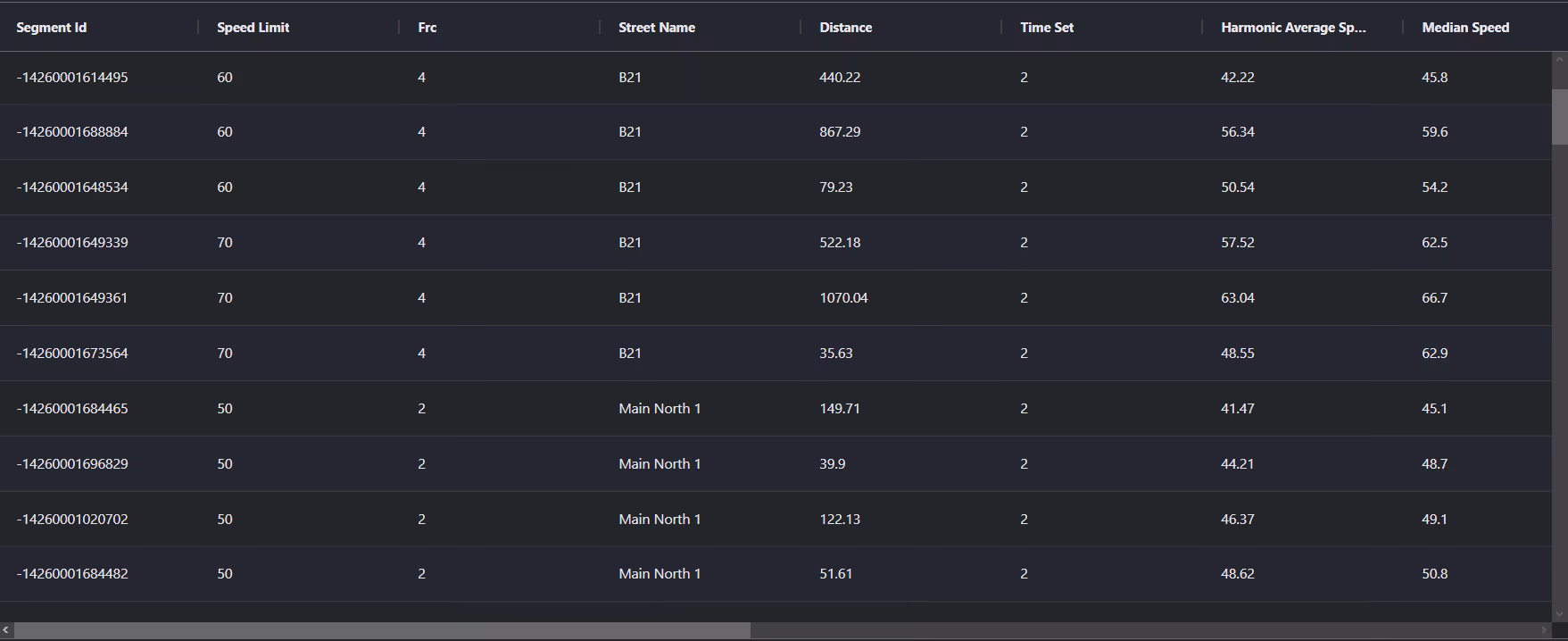
Median Vehicle Speeds by Road Names
This analysis examines median vehicle speeds across various road types, highlighting the efficiency and congestion levels from highways to local streets.
Speed Limit Distribution
Explores the range and prevalence of speed limits throughout Lesotho, pinpointing areas with strict regulations and potential zones for speed limit adjustments.

Functional Road Class (FRC) Distribution
Shows the diversity of road types within the network, from major thoroughfares to local streets, and their distribution across the territory.

Average Speed by Functional Road Class (FRC)
Analyzes average speeds based on road functional classifications, offering insights into traffic flow and congestion differences between arterial roads and local streets.

Average Speed Distribution for Principal Highway
Examines speed patterns along this major road, highlighting areas of congestion or high efficiency and their impact on travel times.

Top 10 Streets by Average Speed
Lists the top 10 streets by average speed, providing an overview of traffic conditions in busy urban areas or on efficient routes.

Maseru Street Traffic Analysis
Presents a detailed examination of traffic flow on Maseru's streets, including peak traffic times, average speeds, and congested areas, supported by visual data.

Why xMap?
xMap empowers businesses with unparalleled location intelligence and comprehensive data analysis, guiding them towards market leadership and growth.
Frequently Asked Questions
Find answers to commonly asked questions about our spatial analyst platform.
This dataset encompasses real-time and historical data on traffic density, accidents, road conditions, and congestion trends.
Leverage this dataset for site selection, analyze road traffic on your desired business location, enhanced route planning, strategic urban development projects, and to implement proactive traffic management strategies.
At xMap, we are committed to ensuring that our clients can leverage our datasets effectively. We provide comprehensive technical support, including help with data integration, troubleshooting, and optimization of data use. Additionally, we offer consulting services to help businesses understand and analyze traffic data to meet their specific strategic objectives.

