Kuwait - Road Traffic Data
Explore an extensive dataset showcasing the intricate connections between road utilization, traffic jams, and traffic trends across Kuwait. Utilize this vast amount of data to acquire valuable insights for your strategic planning, by thoroughly comprehending the traffic trends within the nation.
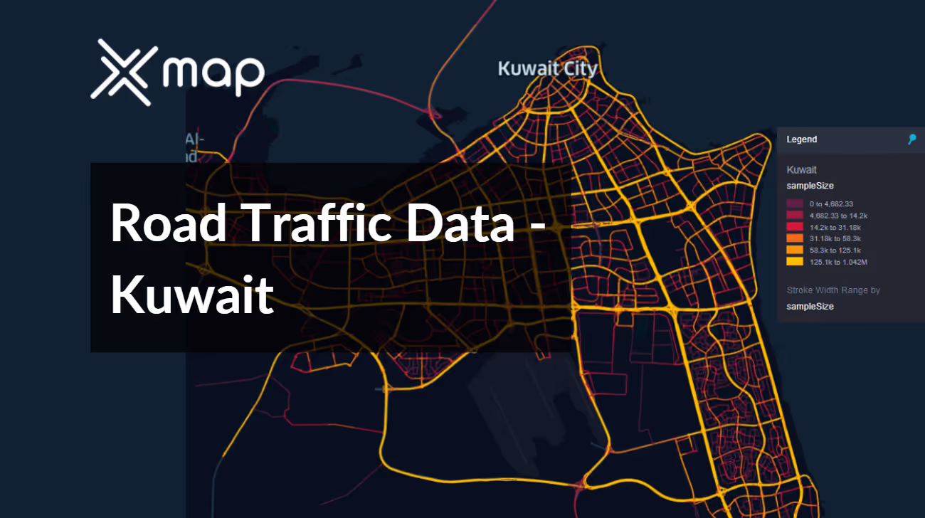


Vital Traffic Insights across the Kuwait
Examine detailed data and research that emphasize the complexities of traffic flow, congested zones, and fluctuations in speed—essential for making well-informed decisions in transportation planning and management throughout Kuwait.
Download a Sample
Preview the depth and breadth of our traffic data collection, showcasing how granular insights can revolutionize transportation planning and management in Kuwait.
.avif)
Key Variables
Examine detailed data and research that emphasize the complexities of traffic flow, congested zones, and fluctuations in speed—essential for making well-informed decisions in transportation planning and management throughout Kuwait.
Use Cases
How can this dataset benefit you?
Leverage the road traffic data to optimize traffic flow in and around Kuwait's oil industry hubs, particularly during shift changes which significantly impact local traffic. Implement strategies such as staggered shift times and optimized routing for company transport services to alleviate congestion and ensure smoother commuting for thousands of workers.
Utilize the traffic data to identify areas with high frequencies of road accidents and traffic violations in Kuwait. Develop targeted road safety campaigns that focus on these hotspots, employing additional signage, enhanced road markings, and public awareness programs aimed at reducing accident rates and promoting safer driving behaviors.
Use Kuwait's road traffic data to implement smart parking solutions in congested urban centers like Kuwait City. Analyze data on parking demand and traffic flow to manage and allocate parking resources dynamically. Introduce smart parking apps that guide drivers to available parking spots, reducing the time spent driving around looking for space and thus decreasing overall traffic congestion.
Everything You need to know to know about the Road Traffic of Kuwait
Median Vehicle Speeds by Road Names
This analysis evaluates the median speeds of vehicles across various road types, highlighting efficiency and congestion levels from highways to local streets.
Speed Limit Distribution
Investigates the range and prevalence of speed limits throughout Kuwait, identifying areas with strict regulations and potential zones for speed limit adjustments.

Functional Road Class (FRC) Distribution
Illustrates the variety of road types within the network, from major thoroughfares to local streets, and their distribution across the territory.

Average Speed by Functional Road Class (FRC)
Analyzes average speeds based on road functional classifications, providing insights into traffic flow and congestion differences between arterial roads and local streets.

Average Speed Distribution for شارع الخليج العربي
Examines speed patterns along this major road, highlighting areas of congestion or high efficiency and their impact on travel times.

Kuwait City Street Traffic Analysis
Presents a detailed examination of traffic flow on Kuwait City's streets, including peak traffic times, average speeds, and congested areas, supported by visual data.

Why xMap?
xMap empowers businesses with unparalleled location intelligence and comprehensive data analysis, guiding them towards market leadership and growth.
Frequently Asked Questions
Find answers to commonly asked questions about our spatial analyst platform.
This dataset is invaluable for urban planners, infrastructure developers, environmental policy makers, and businesses involved in logistics and transportation. It supports strategic decision-making to optimize traffic flow, enhance infrastructure, and develop policies aimed at reducing environmental impacts.
This dataset encompasses real-time and historical data on traffic density, accidents, road conditions, and congestion trends.
At xMap, we are committed to ensuring that our clients can leverage our datasets effectively. We provide comprehensive technical support, including help with data integration, troubleshooting, and optimization of data use. Additionally, we offer consulting services to help businesses understand and analyze traffic data to meet their specific strategic objectives.

