Kazakhstan - Road Traffic Data
Explore a vast data repository showcasing the intricate connections between road utilization, traffic jams, and traffic trends across Kazakhstan. Utilize this comprehensive dataset to acquire vital insights for your strategic planning by thoroughly understanding the traffic trends within the nation.
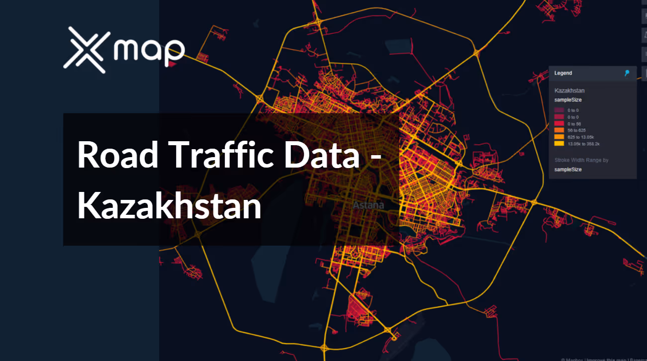


Vital Traffic Insights across the Kazakhstan
Examine comprehensive data and studies that reveal the complexities of traffic flow, congested zones, and speed fluctuations—essential for informed decisions in transportation planning and management throughout Kazakhstan.
Download a Sample
Preview the depth and breadth of our traffic data collection, showcasing how granular insights can revolutionize transportation planning and management in Kazakhstan.
.avif)
Key Variables
Examine comprehensive data and studies that reveal the complexities of traffic flow, congested zones, and speed fluctuations—essential for informed decisions in transportation planning and management throughout Kazakhstan.
Use Cases
How can this dataset benefit you?
Utilize Kazakhstan's road traffic data to identify high-risk sections on major highways, such as the Western Europe-Western China Highway. Analyze accident data and traffic volumes to pinpoint areas that require safety enhancements like improved road markings, additional signage, and speed enforcement measures to reduce accident rates and enhance road safety.
Leverage traffic patterns and congestion data to optimize logistics routes and freight operations across Kazakhstan, particularly for connections between major economic centers like Almaty, Astana, and Shymkent. Use this information to schedule freight movements during lower traffic periods, reducing delivery times and costs while improving overall logistical efficiency.
Implement smart traffic management systems in urban areas using real-time traffic data. In cities like Astana and Almaty, integrate this data with IoT technology to control traffic lights, manage congestion, and provide dynamic routing information to drivers. This will not only improve traffic flow but also support Kazakhstan's ambition to develop smart cities with high-tech, efficient urban environments.
Everything You need to know to know about the Road Traffic of Kazakhstan
Median Vehicle Speeds by Road Names
This analysis evaluates median vehicle speeds across various road types, highlighting efficiency and congestion levels from highways to local streets.
Speed Limit Distribution
Investigates the range and prevalence of speed limits throughout Kazakhstan, identifying areas with strict regulations and potential zones for speed limit adjustments.

Functional Road Class (FRC) Distribution
Illustrates the variety of road types within the network, from major thoroughfares to local streets, and their distribution across the territory.

Average Speed by Functional Road Class (FRC)
Analyzes average speeds based on road functional classifications, providing insights into traffic flow and congestion differences between arterial roads and local streets.

Average Speed Distribution for Астана Объездная дорога
Examines speed patterns along this major road, highlighting areas of congestion or high efficiency and their impact on travel times.

Top 10 Streets by Average Speed
Lists the top 10 streets by average speed, offering an overview of traffic conditions in busy urban areas or on efficient routes.

Astana Street Traffic Analysis
Presents a detailed examination of traffic flow on Astana's streets, including peak traffic times, average speeds, and congested areas, supported by visual data.

Why xMap?
xMap empowers businesses with unparalleled location intelligence and comprehensive data analysis, guiding them towards market leadership and growth.
Frequently Asked Questions
Find answers to commonly asked questions about our spatial analyst platform.
This dataset is invaluable for urban planners, infrastructure developers, environmental policy makers, and businesses involved in logistics and transportation. It supports strategic decision-making to optimize traffic flow, enhance infrastructure, and develop policies aimed at reducing environmental impacts.
This dataset encompasses real-time and historical data on traffic density, accidents, road conditions, and congestion trends.
At xMap, we are committed to ensuring that our clients can leverage our datasets effectively. We provide comprehensive technical support, including help with data integration, troubleshooting, and optimization of data use. Additionally, we offer consulting services to help businesses understand and analyze traffic data to meet their specific strategic objectives.

