Ireland - Road Traffic Data
Discover an extensive data archive that reveals the complex interactions of road usage, congestion, and traffic patterns throughout Ireland. Use this extensive dataset to gather important knowledge for your strategic decision-making by fully comprehending the traffic patterns in the country.


Vital Traffic Insights across the Ireland
Review in-depth data and research that uncovers the intricacies of traffic patterns, congested areas, and speed variations—crucial for well-informed transportation planning and management across Ireland.
Download a Sample
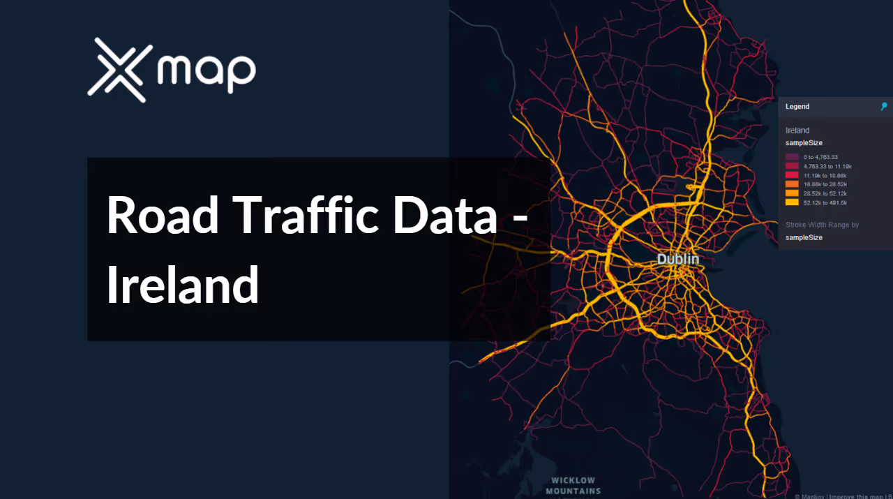
Preview the depth and breadth of our traffic data collection, showcasing how granular insights can revolutionize transportation planning and management in Ireland.
Key Variables
Review in-depth data and research that uncovers the intricacies of traffic patterns, congested areas, and speed variations—crucial for well-informed transportation planning and management across Ireland.
Use Cases
How can this dataset benefit you?
Leverage Ireland’s road traffic data to optimize commuter traffic flows in and out of major cities like Dublin and Cork. Use this information to adjust traffic signal timings, plan reversible lanes, or implement carpooling incentives during peak hours to alleviate congestion and improve overall traffic efficiency.
Develop a real-time traffic information system that provides updates to commuters via mobile apps or digital roadside signs. This system would use Ireland's traffic data to alert drivers about delays, suggest alternative routes, and provide estimated travel times, helping to manage traffic density and reduce commuter frustration.
Utilize traffic flow and density data to strategically place electric vehicle (EV) charging stations across Ireland. By analyzing routes with high traffic volumes and identifying areas with increasing EV usage, this initiative supports the adoption of electric vehicles, aligns with environmental goals, and ensures accessibility and convenience for EV drivers.
Everything You need to know to know about the Road Traffic of Ireland
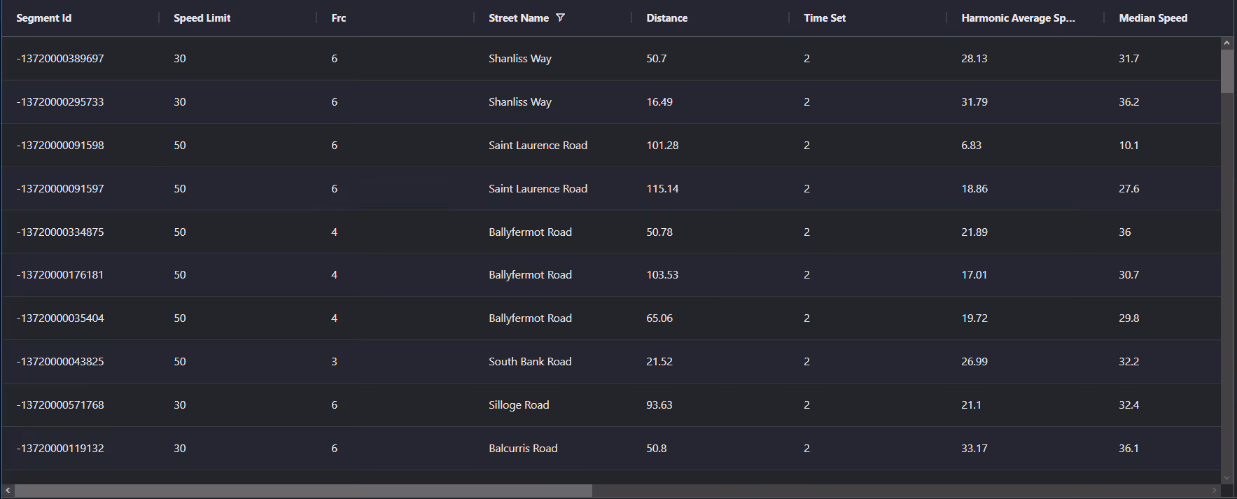
Median Vehicle Speeds by Road Names
This analysis examines the median speeds of vehicles across different road types, highlighting the efficiency and congestion levels from highways to local streets.
Speed Limit Distribution
Investigates the range and prevalence of speed limits throughout Ireland, pinpointing areas with strict regulations and potential zones for speed limit adjustments.

Functional Road Class (FRC) Distribution
Shows the variety of road types within the network, from major thoroughfares to local streets, and their distribution across the territory.

Average Speed by Functional Road Class (FRC)
Analyzes average speeds based on road functional classifications, providing insights into traffic flow and congestion differences between arterial roads and local streets.

Average Speed Distribution for Naas Road
Focuses on speed patterns along this major road, highlighting areas of congestion or high efficiency and their impact on travel times.

Top 10 Streets by Average Speed
Lists the top 10 streets by average speed, offering an overview of traffic conditions in busy urban areas or on efficient routes.

Dublin Street Traffic Analysis
Presents a detailed examination of traffic flow on Dublin's streets, including peak traffic times, average speeds, and congested areas, supported by visual data.

Why xMap?
xMap empowers businesses with unparalleled location intelligence and comprehensive data analysis, guiding them towards market leadership and growth.
Frequently Asked Questions
Find answers to commonly asked questions about our spatial analyst platform.
This dataset encompasses real-time and historical data on traffic density, accidents, road conditions, and congestion trends.
Leverage this dataset for site selection, analyze road traffic on your desired business location, enhanced route planning, strategic urban development projects, and to implement proactive traffic management strategies.
At xMap, we are committed to ensuring that our clients can leverage our datasets effectively. We provide comprehensive technical support, including help with data integration, troubleshooting, and optimization of data use. Additionally, we offer consulting services to help businesses understand and analyze traffic data to meet their specific strategic objectives.

