Hungary - Road Traffic Data
Explore a vast data repository that uncovers the intricate dynamics of road usage, congestion, and traffic flow across Hungary. Gain valuable insights from this comprehensive dataset to guide your strategic decisions with a thorough understanding of the nation's traffic patterns.
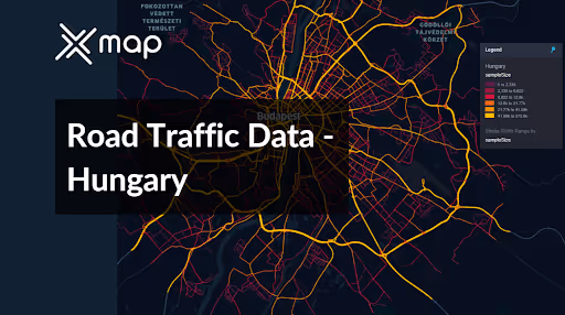


Vital Traffic Insights across the Hungary
Examine detailed metrics and studies that reveal the complexities of traffic flow, congestion hotspots, and speed trends—essential for informed transportation planning and management throughout Hungary.
Download a Sample
Preview the depth and breadth of our traffic data collection, showcasing how granular insights can revolutionize transportation planning and management in Hungary.
.avif)
Key Variables
Examine detailed metrics and studies that reveal the complexities of traffic flow, congestion hotspots, and speed trends—essential for informed transportation planning and management throughout Hungary.
Use Cases
How can this dataset benefit you?
Utilize the road traffic data to implement enhanced traffic management systems in Budapest, focusing on congestion reduction through intelligent traffic signaling and real-time traffic condition updates. This includes dynamic rerouting suggestions to drivers via mobile apps and digital roadside signs to alleviate traffic during peak hours and events.
Leverage traffic volume and trend data to strategically plan highway expansions and improvements, particularly on routes connecting major cities like Szeged, Debrecen, and Győr. Use the data to identify bottlenecks and areas with rising traffic demands to prioritize infrastructure investments that enhance connectivity and reduce travel times.
Employ road traffic data to identify high-risk zones for accidents on rural roads throughout Hungary. Use these insights to target specific areas for safety enhancements, such as better road markings, improved lighting, and the installation of new signage. This proactive approach aims to reduce accident rates and enhance road safety in less urbanized areas.
Everything You need to know to know about the Road Traffic of Hungary
Median Vehicle Speeds by Road Names
This analysis evaluates the median speeds of vehicles across various road types, highlighting efficiency and congestion levels from highways to local streets.
Speed Limit Distribution
Examines the range and prevalence of speed limits throughout Hungary, identifying areas with strict regulations and potential zones for speed limit adjustments.

Functional Road Class (FRC) Distribution
Illustrates the variety of road types within the network, from major thoroughfares to local streets, and their distribution across the territory.

Average Speed by Functional Road Class (FRC)
Analyzes average speeds based on road functional classifications, providing insights into traffic flow and congestion differences between arterial roads and local streets.

Average Speed Distribution for Váci út
Focuses on speed patterns along this major road, highlighting areas of congestion or high efficiency and their impact on travel times.

Top 10 Streets by Average Speed
Lists the top 10 streets by average speed, offering an overview of traffic conditions in busy urban areas or on efficient routes.

Budapest Street Traffic Analysis
Provides a detailed examination of traffic flow on Budapest's streets, including peak traffic times, average speeds, and congested areas, supported by visual data.

Why xMap?
xMap empowers businesses with unparalleled location intelligence and comprehensive data analysis, guiding them towards market leadership and growth.
Frequently Asked Questions
Find answers to commonly asked questions about our spatial analyst platform.
This dataset encompasses real-time and historical data on traffic density, accidents, road conditions, and congestion trends.
This dataset is invaluable for urban planners, infrastructure developers, environmental policy makers, and businesses involved in logistics and transportation. It supports strategic decision-making to optimize traffic flow, enhance infrastructure, and develop policies aimed at reducing environmental impacts.
At xMap, we are committed to ensuring that our clients can leverage our datasets effectively. We provide comprehensive technical support, including help with data integration, troubleshooting, and optimization of data use. Additionally, we offer consulting services to help businesses understand and analyze traffic data to meet their specific strategic objectives.

