Hong Kong - Road Traffic Data
Explore an extensive data repository that reveals the intricate dynamics of road usage, congestion, and traffic flow across Hong Kong. Obtain valuable insights from this comprehensive dataset to guide your strategic decisions with a clear understanding of the territory's traffic patterns.
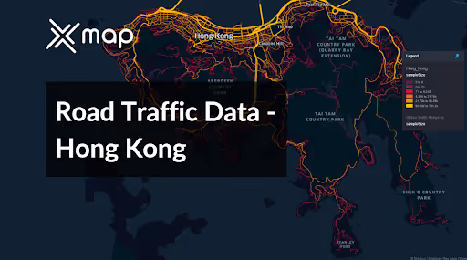


Vital Traffic Insights across the Hong Kong
Analyze detailed metrics and studies that uncover the complexities of traffic flow, congestion hotspots, and speed trends—crucial for informed transportation planning and management throughout Hong Kong.
Download a Sample
Preview the depth and breadth of our traffic data collection, showcasing how granular insights can revolutionize transportation planning and management in Hong Kong.
.avif)
Key Variables
Analyze detailed metrics and studies that uncover the complexities of traffic flow, congestion hotspots, and speed trends—crucial for informed transportation planning and management throughout Hong Kong.
Use Cases
How can this dataset benefit you?
Implement advanced smart traffic management systems using Hong Kong’s road traffic data to dynamically control traffic flow. Integrate data analytics with IoT devices to adjust traffic signals in real-time, deploy intelligent traffic signage, and manage congestion proactively, especially in high-density areas like Central and Kowloon.
Use the road traffic data to enhance the efficiency and reliability of Hong Kong's public transportation network. Analyze patterns of congestion and passenger density to optimize bus and MTR routes, schedules, and frequencies. This helps reduce overcrowding and wait times, improving the daily commute for millions of residents.
Leverage traffic data to guide urban development and roadway expansion decisions in Hong Kong. Identify areas where traffic congestion chronically impedes mobility and use this information to prioritize infrastructure enhancements or new construction projects. This could include expanding existing roadways, adding new traffic lanes, or creating alternative routes to alleviate pressure on heavily trafficked corridors.
Everything You need to know to know about the Road Traffic of Hong Kong
Median Vehicle Speeds by Road Names
This analysis investigates the median vehicle speeds across different road types, highlighting efficiency and congestion levels from highways to local streets.
Speed Limit Distribution
Examines the range and prevalence of speed limits throughout Hong Kong, identifying areas with strict regulations and potential zones for speed limit adjustments.

Functional Road Class (FRC) Distribution
Illustrates the diversity of road types within the network, from major thoroughfares to local streets, and their distribution across the territory.

Average Speed by Functional Road Class (FRC)
Analyzes average speeds based on road functional classifications, providing insights into traffic flow and congestion differences between arterial roads and local streets.

Average Speed Distribution for 中環灣仔繞道-隧道
Focuses on speed patterns along this major road, highlighting areas of congestion or high efficiency and their impact on travel times.

Hong Kong Street Traffic Analysis
Provides a detailed examination of traffic flow on Hong Kong's streets, including peak traffic times, average speeds, and congested areas, supported by visual data.

Why xMap?
xMap empowers businesses with unparalleled location intelligence and comprehensive data analysis, guiding them towards market leadership and growth.
Frequently Asked Questions
Find answers to commonly asked questions about our spatial analyst platform.
This dataset is invaluable for urban planners, infrastructure developers, environmental policy makers, and businesses involved in logistics and transportation. It supports strategic decision-making to optimize traffic flow, enhance infrastructure, and develop policies aimed at reducing environmental impacts.
This dataset encompasses real-time and historical data on traffic density, accidents, road conditions, and congestion trends.
At xMap, we are committed to ensuring that our clients can leverage our datasets effectively. We provide comprehensive technical support, including help with data integration, troubleshooting, and optimization of data use. Additionally, we offer consulting services to help businesses understand and analyze traffic data to meet their specific strategic objectives.

