Greece - Road Traffic Data
Explore a vast data repository that uncovers the intricate dynamics of road usage, congestion, and traffic flow across Greece. Gain valuable insights from this comprehensive dataset to guide your strategic decisions with a thorough understanding of the nation's traffic patterns.
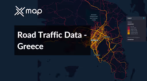


Vital Traffic Insights across the Greece
Examine detailed metrics and studies that reveal the complexities of traffic flow, congestion hotspots, and speed trends—essential for informed transportation planning and management throughout Greece.
Download a Sample
Preview the depth and breadth of our traffic data collection, showcasing how granular insights can revolutionize transportation planning and management in Greece.
.avif)
Key Variables
Examine detailed metrics and studies that reveal the complexities of traffic flow, congestion hotspots, and speed trends—essential for informed transportation planning and management throughout Greece.
Use Cases
How can this dataset benefit you?
Use Greece’s road traffic data to manage and optimize the flow of vehicles in tourist-heavy areas like Athens, Mykonos, and Santorini. Develop targeted strategies such as designated tourist vehicle lanes, optimized parking solutions, and real-time traffic guidance systems to manage the seasonal surge effectively, ensuring a smoother travel experience for visitors and reducing disruption for local residents.
Leverage traffic data to inform urban planning and improve public transportation systems in rapidly growing cities such as Thessaloniki. Analyze peak traffic hours and key congestion zones to enhance bus and metro services, route planning, and to support the development of new transit routes, reducing overall traffic density and promoting more sustainable urban mobility.
Employ detailed traffic flow and accident data to identify high-risk areas on Greek roads. Implement safety measures such as improved road signage, enhanced lighting, and traffic calming devices in these areas. Additionally, use the data to conduct public awareness campaigns about road safety, especially targeting regions with historically high accident rates, thereby reducing accidents and enhancing road safety for all users.
Everything You need to know to know about the Road Traffic of Greece
Median Vehicle Speeds by Road Names
This analysis evaluates the median speeds of vehicles across various road types, highlighting efficiency and congestion levels from highways to local streets.
Speed Limit Distribution
Examines the range and prevalence of speed limits throughout Greece, identifying areas with strict regulations and potential zones for speed limit adjustments.

Functional Road Class (FRC) Distribution
Illustrates the variety of road types within the network, from major thoroughfares to local streets, and their distribution across the territory.

Average Speed by Functional Road Class (FRC)
Analyzes average speeds based on road functional classifications, providing insights into traffic flow and congestion differences between arterial roads and local streets.

Average Speed Distribution for Λεωφόρος Μαραθώνος
Focuses on speed patterns along this major road, highlighting areas of congestion or high efficiency and their impact on travel times.

Top 10 Streets by Average Speed
Lists the top 10 streets by average speed, offering an overview of traffic conditions in busy urban areas or on efficient routes.

Athens Street Traffic Analysis
Provides a detailed examination of traffic flow on Athens's streets, including peak traffic times, average speeds, and congested areas, supported by visual data.

Why xMap?
xMap empowers businesses with unparalleled location intelligence and comprehensive data analysis, guiding them towards market leadership and growth.
Frequently Asked Questions
Find answers to commonly asked questions about our spatial analyst platform.
This dataset is invaluable for urban planners, infrastructure developers, environmental policy makers, and businesses involved in logistics and transportation. It supports strategic decision-making to optimize traffic flow, enhance infrastructure, and develop policies aimed at reducing environmental impacts.
This dataset encompasses real-time and historical data on traffic density, accidents, road conditions, and congestion trends.
At xMap, we are committed to ensuring that our clients can leverage our datasets effectively. We provide comprehensive technical support, including help with data integration, troubleshooting, and optimization of data use. Additionally, we offer consulting services to help businesses understand and analyze traffic data to meet their specific strategic objectives.

