Egypt - Road Traffic Data
Navigate the complexities of Egypt's bustling road networks with our extensive traffic dataset, which provides detailed insights into traffic flows, congestion levels, and vehicle distribution across major cities and transport routes. This invaluable resource is perfect for governmental agencies, urban planners, and private enterprises looking to streamline traffic management, enhance transportation planning, and boost infrastructural developments throughout Egypt.
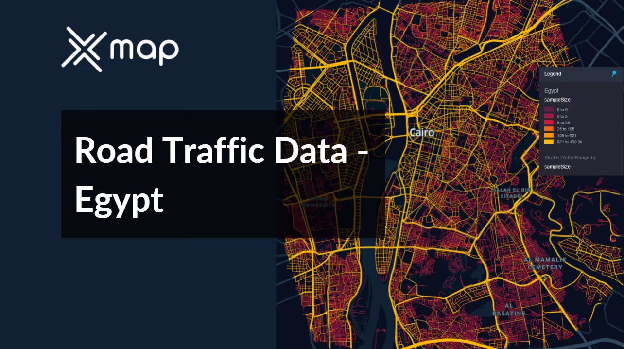


Vital Traffic Insights across the Egypt
Delve into detailed metrics and analyses that reveal the nuances of traffic flow, congestion hotspots, and speed trends—essential for informed transportation planning and management throughout Egypt.
Download a Sample
Preview the depth and breadth of our traffic data collection, showcasing how granular insights can revolutionize transportation planning and management in Egypt.
.avif)
Key Variables
Delve into detailed metrics and analyses that reveal the nuances of traffic flow, congestion hotspots, and speed trends—essential for informed transportation planning and management throughout Egypt.
Use Cases
How can this dataset benefit you?
Implement smart traffic control systems using Egypt’s road traffic data to manage and mitigate congestion in Cairo, one of the busiest cities in Africa. Utilize AI-driven algorithms to analyze traffic patterns and automatically adjust signal timings in real-time, improving traffic flow and reducing vehicle idle times.
Leverage traffic data to manage and optimize the flow of tourist vehicles to Egypt's renowned historical sites such as the Pyramids of Giza and Luxor. Develop strategies like timed entry slots and improved routing information to facilitate smoother access and enhance the visitor experience while preserving the integrity of these sites.
Use traffic volume and trend analysis from the dataset to prioritize road maintenance and infrastructure development projects across Egypt. Focus on upgrading roads that handle high traffic volumes and are critical to economic activities, ensuring they are safe and efficient for transport and trade purposes.
Everything You need to know to know about the Road Traffic of Egypt
Median Speed by Street Names
This analysis examines the median vehicle speeds across various road types, highlighting efficiency and congestion levels from highways to local streets.
Distribution of Speed Limits
Investigates the range and prevalence of speed limits throughout Egypt, pinpointing areas with strict regulations and potential zones for speed limit adjustments.

Distribution of Functional Road Classes (FRC)
Showcases the diversity of road types within the network, from major roads to local streets, and their distribution across the country.

Average Speed by Functional Road Class (FRC)
Breaks down average speeds by road functional classification, providing insights into traffic flow and congestion on arterial roads compared to local streets.

Average Speed Distribution for شارع صلاح سالم
Focuses on speed patterns along this major road, highlighting areas of congestion or high efficiency and their impact on travel times.

Cairo Street Traffic Analysis
Provides a detailed examination of traffic flow in Cairo, including peak times, average speeds, and congestion points, illustrated with visual data.

Why xMap?
xMap empowers businesses with unparalleled location intelligence and comprehensive data analysis, guiding them towards market leadership and growth.
Frequently Asked Questions
Find answers to commonly asked questions about our spatial analyst platform.
This dataset encompasses real-time and historical data on traffic density, accidents, road conditions, and congestion trends.
Leverage this dataset for site selection, analyze road traffic on your desired business location, enhanced route planning, strategic urban development projects, and to implement proactive traffic management strategies.
At xMap, we are committed to ensuring that our clients can leverage our datasets effectively. We provide comprehensive technical support, including help with data integration, troubleshooting, and optimization of data use. Additionally, we offer consulting services to help businesses understand and analyze traffic data to meet their specific strategic objectives.

