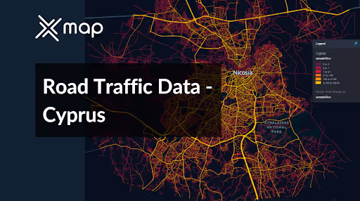
Cyprus - Road Traffic Data
Dive into a comprehensive data repository that reveals the complex dynamics of road usage, congestion, and traffic flow across Cyprus. Obtain valuable insights from this extensive dataset to inform your strategic decisions with a clear understanding of the nation's traffic patterns.


Vital Traffic Insights across the Cyprus
Discover comprehensive metrics and analyses that unveil the subtleties of traffic flow, congestion hotspots, and speed trends—crucial for informed transportation planning and management across Cyprus.
Download a Sample
Preview the depth and breadth of our traffic data collection, showcasing how granular insights can revolutionize transportation planning and management in Cyprus.
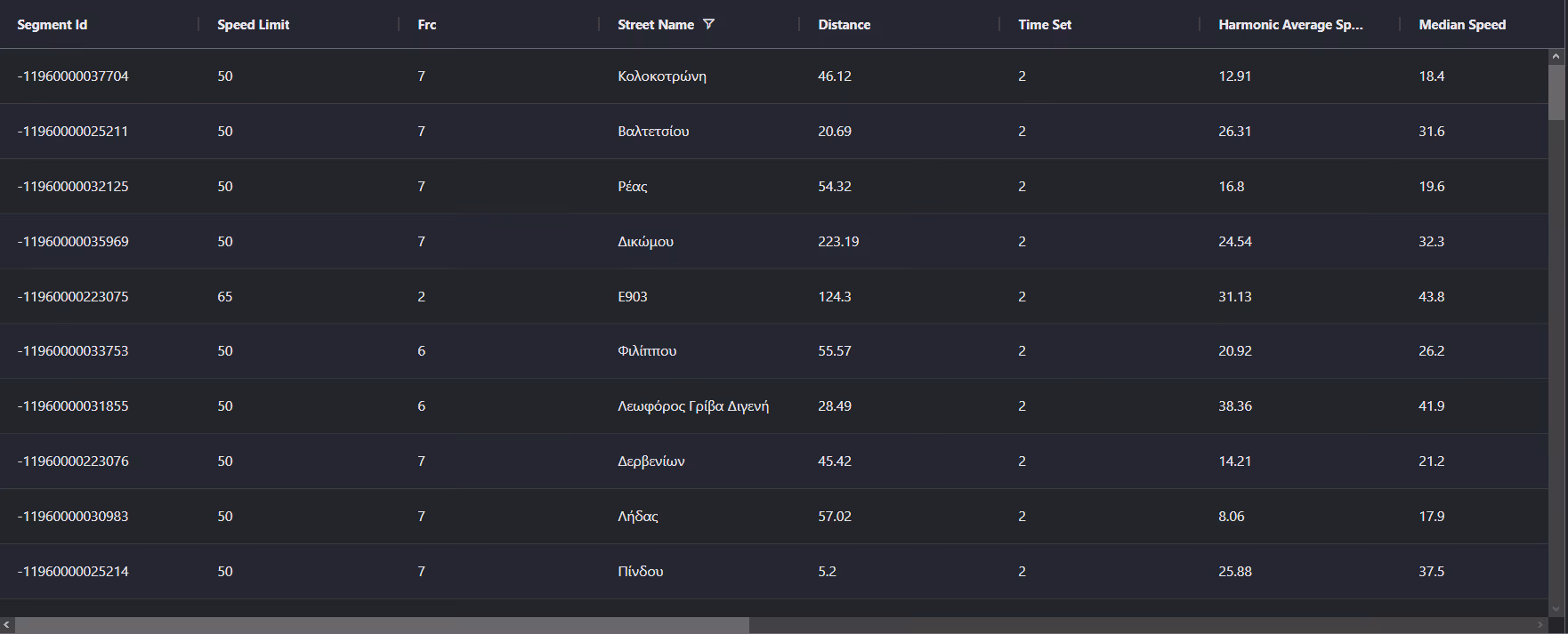
Key Variables
Discover comprehensive metrics and analyses that unveil the subtleties of traffic flow, congestion hotspots, and speed trends—crucial for informed transportation planning and management across Cyprus.
Use Cases
How can this dataset benefit you?
Leverage Cyprus's road traffic data to optimize traffic flow during peak tourist seasons. Analyze traffic patterns around key tourist destinations to implement strategic interventions such as directional signage, adjusted parking regulations, and shuttle services. This will enhance visitor experiences and alleviate congestion in tourist hotspots.
Use traffic data to inform sustainable urban planning initiatives in growing cities like Nicosia and Limassol. By understanding current traffic flows and bottlenecks, urban planners can design city layouts that encourage public transport use, biking, and walking, reducing dependence on private vehicles and promoting a greener urban environment.
Develop a real-time traffic information system using the road traffic data from Cyprus. Provide drivers with up-to-date information on traffic conditions, road works, and accidents through mobile apps or in-car systems. This initiative can significantly reduce travel times, improve fuel efficiency, and decrease the frustration associated with unexpected road conditions.
Everything You need to know to know about the Road Traffic of Cyprus
Median Vehicle Speeds by Road Names
This analysis delves into the median speeds of vehicles across a variety of road types, highlighting the effectiveness and congestion levels ranging from highways to local streets.
Speed Limit Distribution
Examines the spread and prevalence of speed limits throughout Cyprus, identifying areas with stringent regulations and potential zones for adjustments to speed limits.

Distribution of Functional Road Classes (FRC)
Showcases the assortment of road types within the network, spanning major thoroughfares to local roads, and their dispersion across the nation.

Average Speed by Functional Road Class (FRC)
Breaks down average speeds based on road functional classifications, providing insights into traffic flow and congestion on main roads compared to local streets.

Average Speed Distribution for Doktor Fazıl Küçük Bulvarı
Focuses on speed patterns along this significant road, demonstrating congested areas or zones of high efficiency and their impact on travel times.

Top 10 Streets by Average Speed
Enumerates the top 10 streets in terms of average speed, offering a snapshot of traffic conditions in bustling urban areas or efficient routes.

Nicosia Street Traffic Analysis
Provides an in-depth examination of traffic flow in Nicosia, including peak hours, average speeds, and congested areas, supported by visual data.

Why xMap?
xMap empowers businesses with unparalleled location intelligence and comprehensive data analysis, guiding them towards market leadership and growth.
Frequently Asked Questions
Find answers to commonly asked questions about our spatial analyst platform.
This dataset encompasses real-time and historical data on traffic density, accidents, road conditions, and congestion trends.
Leverage this dataset for site selection, analyze road traffic on your desired business location, enhanced route planning, strategic urban development projects, and to implement proactive traffic management strategies.
At xMap, we are committed to ensuring that our clients can leverage our datasets effectively. We provide comprehensive technical support, including help with data integration, troubleshooting, and optimization of data use. Additionally, we offer consulting services to help businesses understand and analyze traffic data to meet their specific strategic objectives.

