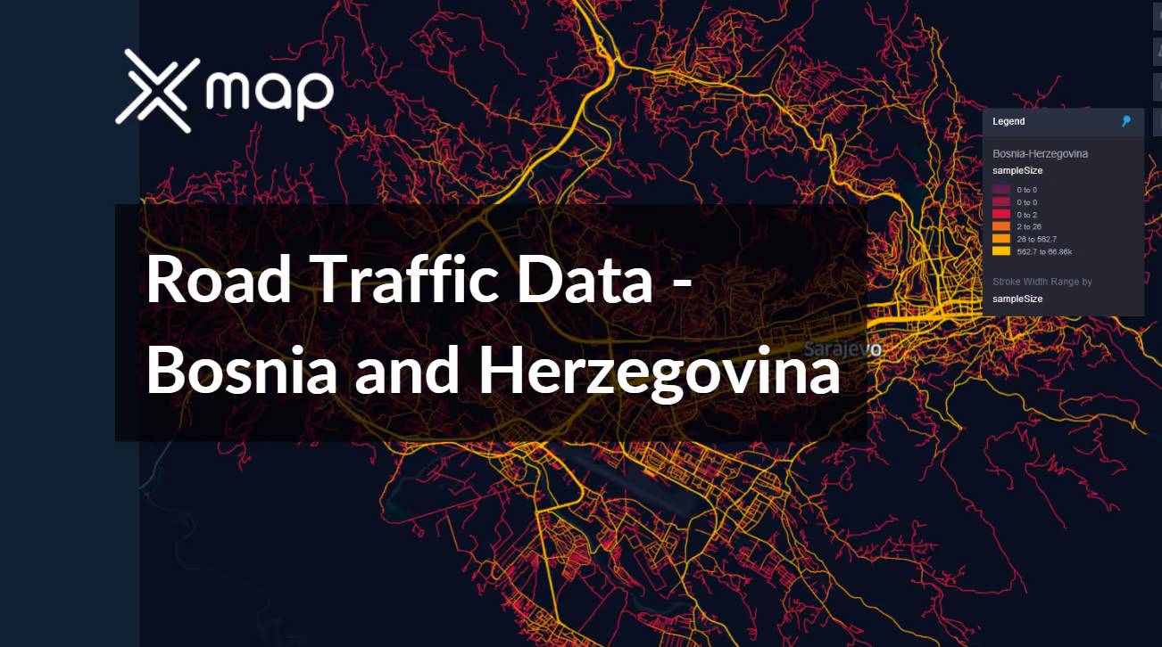
Bosnia and Herzegovina - Road Traffic Data
Explore a comprehensive repository of data that reveals the intricate dynamics of road usage, congestion, and traffic flow across Bosnia and Herzegovina. Gain invaluable insights from this extensive dataset to guide your strategic decisions with a clear understanding of the nation's traffic patterns.


Vital Traffic Insights across the Bosnia and Herzegovina
Explore detailed metrics and analyses that uncover the nuances of traffic flow, congestion hotspots, and speed trends—vital for informed transportation planning and management across Bosnia and Herzegovina.
Download a Sample
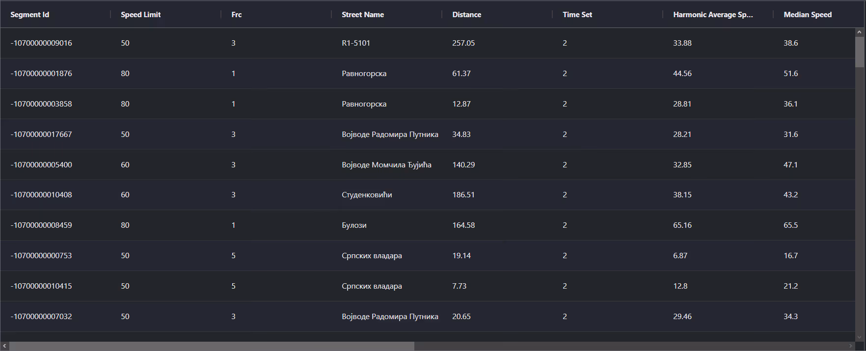
Preview the depth and breadth of our traffic data collection, showcasing how granular insights can revolutionize transportation planning and management in Bosnia and Herzegovina.
Key Variables
Explore detailed metrics and analyses that uncover the nuances of traffic flow, congestion hotspots, and speed trends—vital for informed transportation planning and management across Bosnia and Herzegovina.
Use Cases
How can this dataset benefit you?
Utilize the road traffic data of Bosnia and Herzegovina to manage and optimize the flow of tourist vehicles, especially in historical cities like Mostar and Sarajevo. Implement smart traffic management systems that guide tourist buses and personal vehicles efficiently, reducing congestion and preserving the ambiance of heritage sites.
Leverage traffic data to analyze and improve cross-border transportation routes between Bosnia and Herzegovina and its neighboring countries. Use insights from the data to streamline customs processes, enhance border crossing points, and improve overall trade efficiency, supporting the country's economic growth.
Employ road traffic data to plan and optimize emergency response routes in rural areas of Bosnia and Herzegovina. This includes determining the quickest routes for ambulance and fire services, taking into account road conditions and typical traffic patterns, ensuring faster response times during emergencies and natural disasters.
Everything You need to know to know about the Road Traffic of Bosnia and Herzegovina
Median Speed by Street Names
This analysis explores the median vehicle speeds across various road types, highlighting efficiency and congestion levels from highways to local streets.
Distribution of Speed Limits
Analyzes the range and prevalence of speed limits across Bosnia and Herzegovina, identifying zones of strict regulation and potential areas for speed limit adjustments.

Distribution of Functional Road Classes (FRC)
Highlights the diversity of road types within the network, from major roads to local roads, and their distribution across the country.

Average Speed by Functional Road Class (FRC)
Breaks down average speeds by road functional classification, offering insights into traffic flow and congestion on arterial roads compared to local roads.

Average Speed Distribution for Put Mladih Muslimana
Focuses on speed patterns along this major road, showcasing areas of congestion or high efficiency and their impact on travel times.

Average Speed by Street Name (Top 10 streets)
Lists the top 10 streets in terms of average speed, offering a snapshot of traffic conditions in busy urban areas or efficient thoroughfares.

Sarajevo Street Road Traffic
Presents a detailed analysis of Sarajevo's traffic flow, including peak times, average speeds, and congestion points, illustrated with visual data.

Why xMap?
xMap empowers businesses with unparalleled location intelligence and comprehensive data analysis, guiding them towards market leadership and growth.
Frequently Asked Questions
Find answers to commonly asked questions about our spatial analyst platform.
This dataset encompasses real-time and historical data on traffic density, accidents, road conditions, and congestion trends.
Leverage this dataset for site selection, analyze road traffic on your desired business location, enhanced route planning, strategic urban development projects, and to implement proactive traffic management strategies.
The Austria Road Traffic dataset encompasses detailed metrics such as vehicle counts, types, speed, congestion levels, and time-stamped traffic flow patterns across various routes. This data is crucial for analyzing peak traffic times and identifying key congestion points.

