Belgium - Road Traffic Data
Explore an exceptional repository of data that reveals the intricate dynamics of road usage, congestion, and traffic flow across Belgium. Obtain invaluable insights from this extensive dataset to guide your strategic decisions with a clear understanding of the nation's traffic patterns.
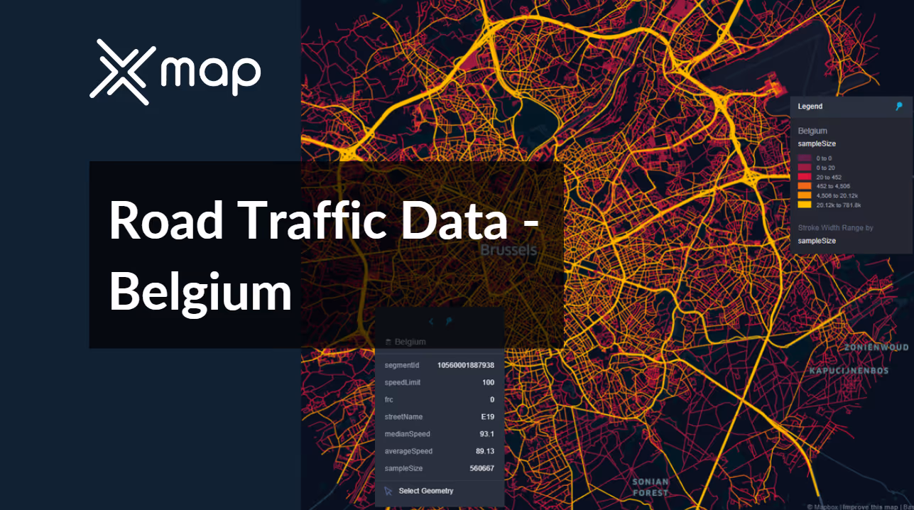


Vital Traffic Insights across the Belgium
Unearth detailed metrics and analyses that unveil the subtleties of traffic flow, congestion hotspots, and speed trends—vital for informed transportation planning and management across Belgium.
Download a Sample
Preview the depth and breadth of our traffic data collection, showcasing how granular insights can revolutionize transportation planning and management in Belgium.
.avif)
Key Variables
Unearth detailed metrics and analyses that unveil the subtleties of traffic flow, congestion hotspots, and speed trends—vital for informed transportation planning and management across Belgium.
Use Cases
How can this dataset benefit you?
Leverage traffic data to optimize the synchronization of public transport schedules with peak traffic times across Belgium. This approach aims to reduce wait times for buses and trams during rush hours, enhance connectivity between different modes of transport, and encourage public transport usage as a viable alternative to driving.
Use insights from traffic flow data to strategically locate new retail and commercial hubs in Belgium. Determine the best locations based on ease of access and potential customer volume, thereby maximizing foot traffic and economic activity in newly developed areas. This use case supports economic growth by aligning commercial developments with traffic patterns and consumer accessibility.
Utilize traffic data to assess and enhance cycling infrastructure in Belgium, a country known for its cycling culture. By analyzing road traffic patterns, identify areas where bike lanes can be improved or expanded to ensure safety and encourage more people to cycle, reducing vehicular traffic and promoting healthier lifestyles.
Everything You need to know to know about the Road Traffic of Belgium
Median Speed by Street Names
This analysis explores the median vehicle speeds across various road types, highlighting efficiency and congestion levels from highways to local streets.
Distribution of Speed Limits
Analyzes the range and prevalence of speed limits across Belgium, identifying zones of strict regulation and potential areas for speed limit adjustments.

Distribution of Functional Road Classes (FRC)
Highlights the diversity of road types within the network, from major roads to local roads, and their distribution across the country.

Average Speed by Functional Road Class (FRC)
Breaks down average speeds by road functional classification, offering insights into traffic flow and congestion on arterial roads compared to local roads.

Average Speed Distribution for E19
Focuses on speed patterns along this major road, showcasing areas of congestion or high efficiency and their impact on travel times.

Average Speed by Street Name (Top 10 streets)
Lists the top 10 streets in terms of average speed, offering a snapshot of traffic conditions in busy urban areas or efficient thoroughfares.

Brussels Street Road Traffic
Presents a detailed analysis of Brussels's traffic flow, including peak times, average speeds, and congestion points, illustrated with visual data.

Why xMap?
xMap empowers businesses with unparalleled location intelligence and comprehensive data analysis, guiding them towards market leadership and growth.
Frequently Asked Questions
Find answers to commonly asked questions about our spatial analyst platform.
This dataset encompasses real-time and historical data on traffic density, accidents, road conditions, and congestion trends.
It would be deal for traffic analysis, median speed, trend analysis and forecasting.
At xMap, we are committed to ensuring that our clients can leverage our datasets effectively. We provide comprehensive technical support, including help with data integration, troubleshooting, and optimization of data use. Additionally, we offer consulting services to help businesses understand and analyze traffic data to meet their specific strategic objectives.

