Belarus - Road Traffic Data
Dive into the complexities of Belarus' road traffic with our extensive dataset, offering detailed insights into traffic patterns, congestion levels, and vehicle types across the nation. This dataset is crucial for transportation authorities, urban planners, and infrastructure developers, enabling them to craft effective traffic management strategies, enhance public transportation routes, and implement sustainable urban development projects throughout Belarus.
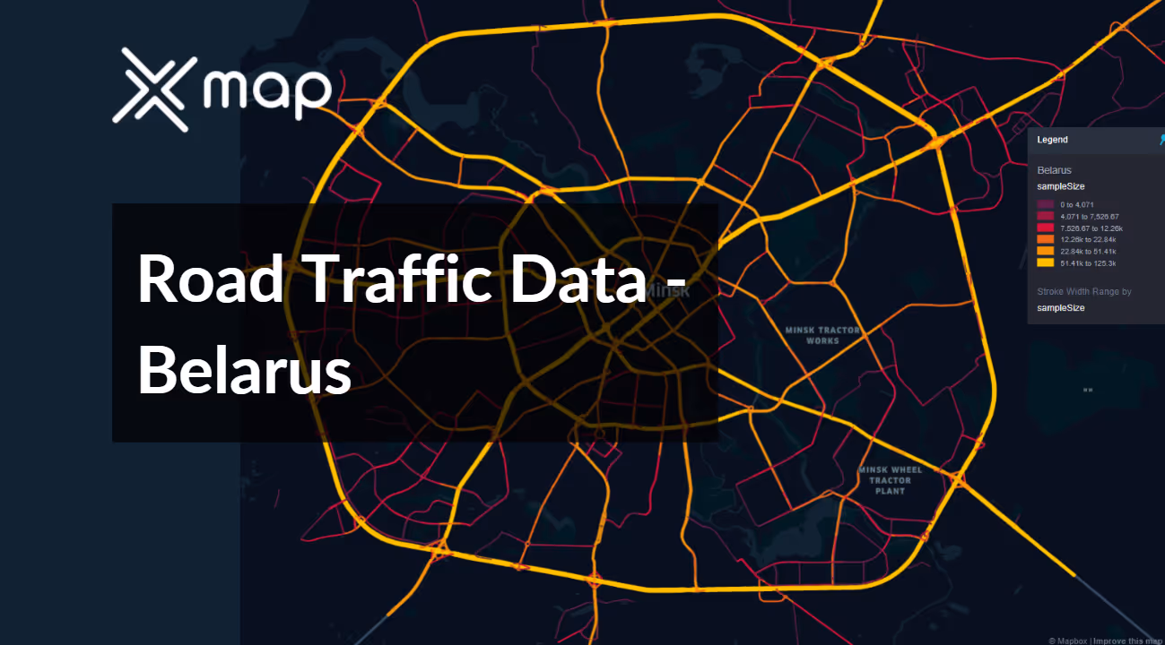


Vital Traffic Insights across the Belarus
Explore detailed information and research that offer insights into the intricacies of traffic flow, congested areas, and necessary speed adjustments for making informed decisions when planning transportation systems in Belarus.
Download a Sample
Preview the depth and breadth of our traffic data collection, showcasing how granular insights can revolutionize transportation planning and management in Belarus.
.avif)
Key Variables
Explore detailed information and research that offer insights into the intricacies of traffic flow, congested areas, and necessary speed adjustments for making informed decisions when planning transportation systems in Belarus.
Use Cases
How can this dataset benefit you?
Utilize Belarus's road traffic data to develop and implement intelligent traffic systems in Minsk. These systems can manage traffic flow dynamically through real-time data analysis, adjusting traffic signals, suggesting alternative routes during congestion via mobile apps, and providing predictive analytics to prevent traffic jams before they start.
Leverage the traffic data to prioritize and plan infrastructure enhancements across Belarus. Analyze traffic volumes and patterns to identify critical areas where road expansions, new road constructions, or repairs are needed to accommodate current and future traffic demands, especially in rapidly developing regions.
Employ traffic volume and flow data for environmental impact assessments, particularly in urban areas. Use this information to identify high emission zones and times of peak pollution, informing policy decisions like the creation of low-emission zones, promotion of electric vehicle use, and enhancement of public transport systems to reduce overall environmental impact from road traffic.
Everything You need to know to know about the Road Traffic of Belarus
Median Vehicle Speeds by Road Names
This analysis evaluates median vehicle speeds across various road types, highlighting efficiency and congestion levels from highways to local streets.
Speed Limit Distribution
Explores the range and prevalence of speed limits throughout Belarus, identifying areas with strict regulations and potential zones for speed limit adjustments.

Functional Road Class (FRC) Distribution
Illustrates the variety of road types within the network, from major thoroughfares to local streets, and their distribution across the territory.

Average Speed by Functional Road Class (FRC)
Analyzes average speeds based on road functional classifications, providing insights into traffic flow and congestion differences between arterial roads and local streets.

Average Speed Distribution for Партызанскі праспект
Examines speed patterns along this major road, highlighting areas of congestion or high efficiency and their impact on travel times.

Top 10 Streets by Average Speed
Lists the top 10 streets by average speed, offering an overview of traffic conditions in busy urban areas or on efficient routes.

Minsk Street Traffic Analysis
Presents a detailed examination of traffic flow on Minsk’s streets, including peak traffic times, average speeds, and congested areas, supported by visual data.

Why xMap?
xMap empowers businesses with unparalleled location intelligence and comprehensive data analysis, guiding them towards market leadership and growth.
Frequently Asked Questions
Find answers to commonly asked questions about our spatial analyst platform.
This dataset encompasses real-time and historical data on traffic density, accidents, road conditions, and congestion trends.
Leverage this dataset for site selection, analyze road traffic on your desired business location, enhanced route planning, strategic urban development projects, and to implement proactive traffic management strategies.
At xMap, we are committed to ensuring that our clients can leverage our datasets effectively. We provide comprehensive technical support, including help with data integration, troubleshooting, and optimization of data use. Additionally, we offer consulting services to help businesses understand and analyze traffic data to meet their specific strategic objectives.

